MyTopo
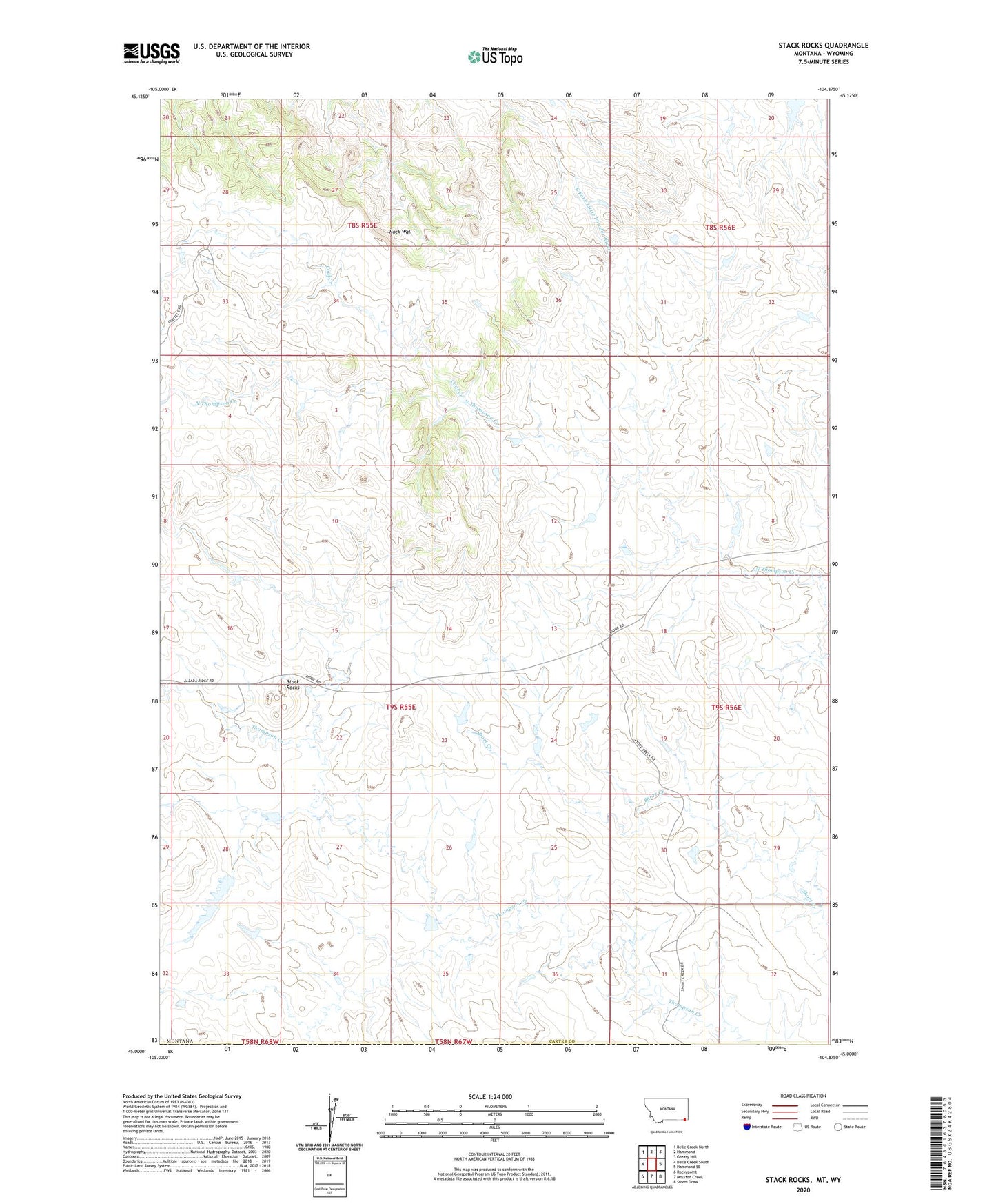
Stack Rocks Montana US Topo Map
Couldn't load pickup availability
2024 topographic map quadrangle Stack Rocks in the state of Montana. Scale: 1:24000. Based on the newly updated USGS 7.5' US Topo map series, this map is in the following counties: Carter, Crook. The map contains contour data, water features, and other items you are used to seeing on USGS maps, but also has updated roads and other features. This is the next generation of topographic maps. Printed on high-quality waterproof paper with UV fade-resistant inks.
Quads adjacent to this one:
West: Belle Creek South
Northwest: Belle Creek North
North: Hammond
Northeast: Greasy Hill
East: Hammond SE
Southeast: Storm Draw
South: Moulton Creek
Southwest: Rockypoint
Contains the following named places: Ace of Diamonds Dam, Coal Creek, Gerald Craft Number 6 Dam, Jack of Diamonds Dam, Jack of Hearts Dam, Jack of Spades Dam, King of Diamonds Dam, Queen of Hearts Dam, Rock Wall, Stack Rocks, Thompson Creek