MyTopo
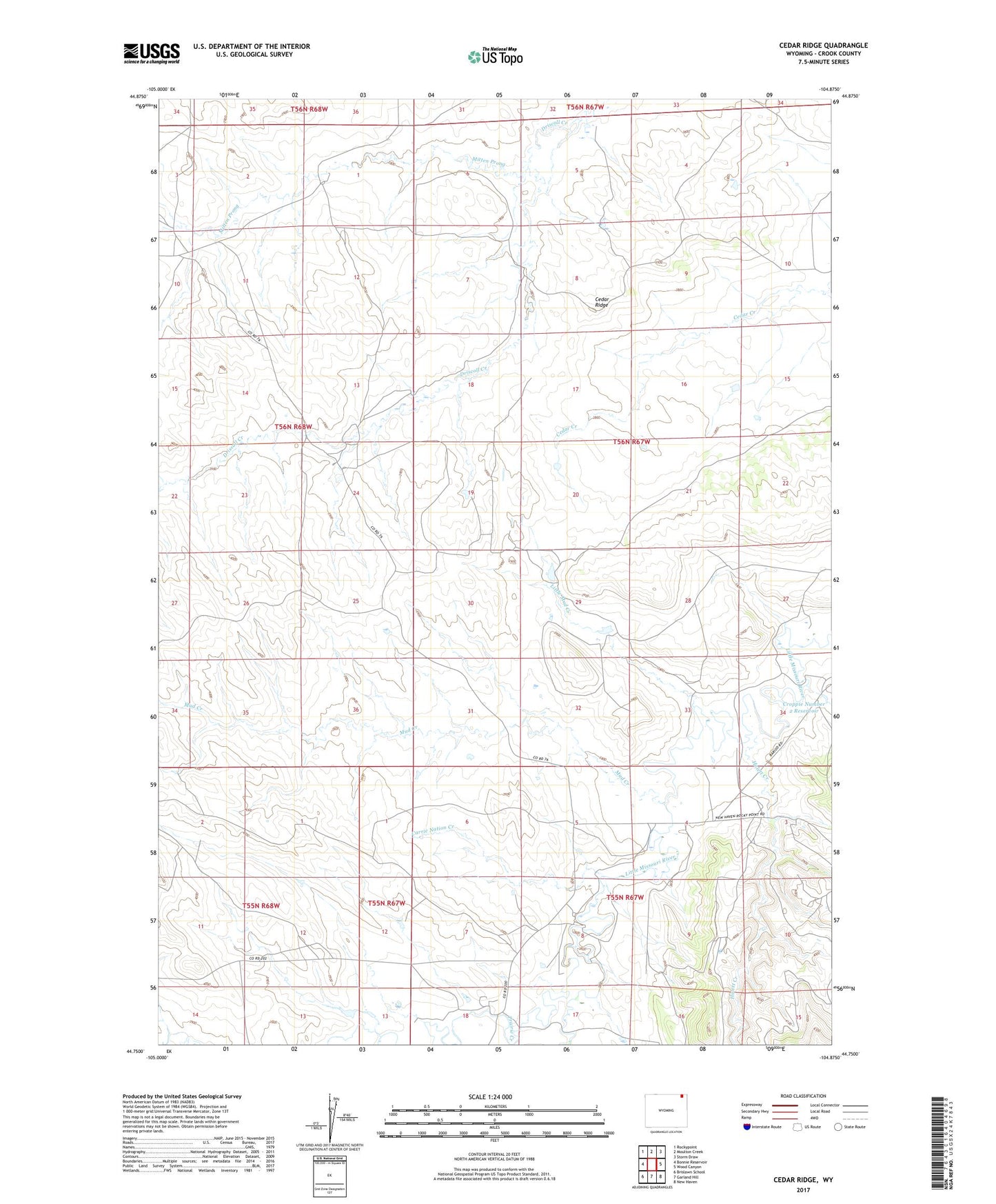
Cedar Ridge Wyoming US Topo Map
Couldn't load pickup availability
2021 topographic map quadrangle Cedar Ridge in the state of Wyoming. Scale: 1:24000. Based on the newly updated USGS 7.5' US Topo map series, this map is in the following counties: Crook. The map contains contour data, water features, and other items you are used to seeing on USGS maps, but also has updated roads and other features. This is the next generation of topographic maps. Printed on high-quality waterproof paper with UV fade-resistant inks.
Quads adjacent to this one:
West: Bonnie Reservoir
Northwest: Rockypoint
North: Moulton Creek
Northeast: Storm Draw
East: Wood Canyon
Southeast: New Haven
South: Garland Hill
Southwest: Brislawn School
This map covers the same area as the classic USGS quad with code o44104g8.
Contains the following named places: Carrie Nation Creek, Cedar Ridge, Croppie Number 2 Reservoir, Homestake Mines, Homestake Pit Number Five Mine, Homestake Pit Number Four Mine, Homestake Pit Number One Mine, Homestake Pit Number Three Mine, Homestake Pit Number Two Mine, Hulett Creek, Hulett Creek School, Lewis Dennis Mine, Little Mud Creek, Mitten Prong, Mud Creek, Prairie Creek, Sabatka Creek, Sodak Mine