MyTopo
Rolling Pin Ranch Wyoming US Topo Map
Couldn't load pickup availability
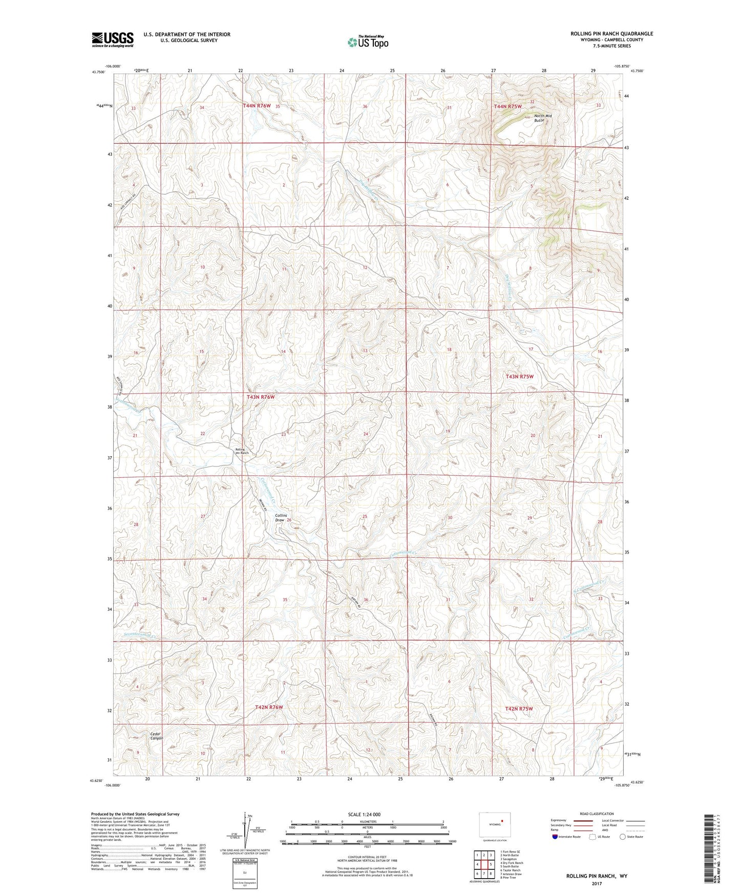
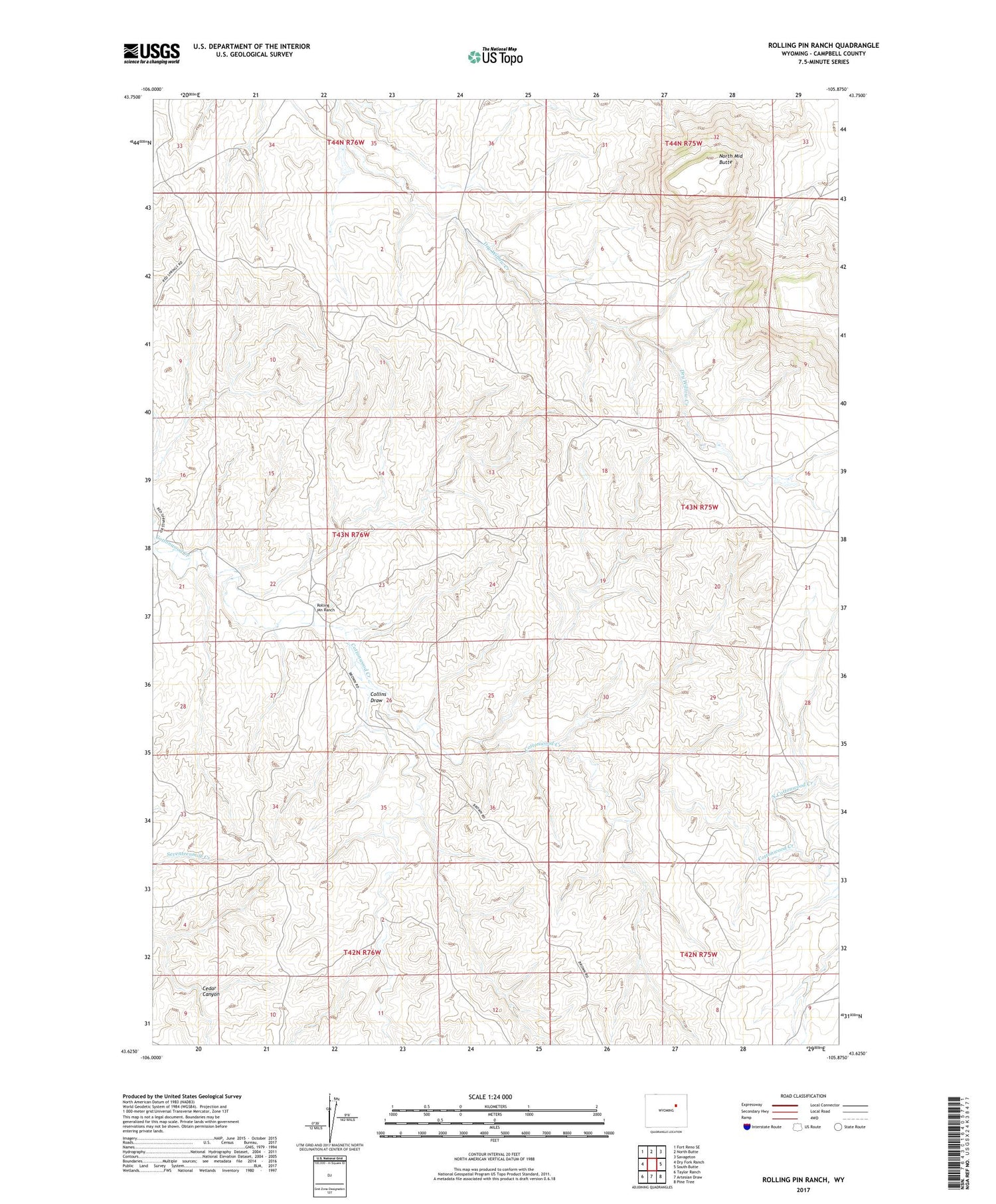
2021 topographic map quadrangle Rolling Pin Ranch in the state of Wyoming. Scale: 1:24000. Based on the newly updated USGS 7.5' US Topo map series, this map is in the following counties: Campbell. The map contains contour data, water features, and other items you are used to seeing on USGS maps, but also has updated roads and other features. This is the next generation of topographic maps. Printed on high-quality waterproof paper with UV fade-resistant inks.
Quads adjacent to this one:
West: Dry Fork Ranch
Northwest: Fort Reno SE
North: North Butte
Northeast: Savageton
East: South Butte
Southeast: Pine Tree
South: Artesian Draw
Southwest: Taylor Ranch
Contains the following named places: Brown Dam, Brown Reservoir, Collins Draw, North Cottonwood Creek, North Middle Butte, Pumpkin Butte Ranch, Rolling Pin Ranch