MyTopo
Savageton Wyoming US Topo Map
Couldn't load pickup availability
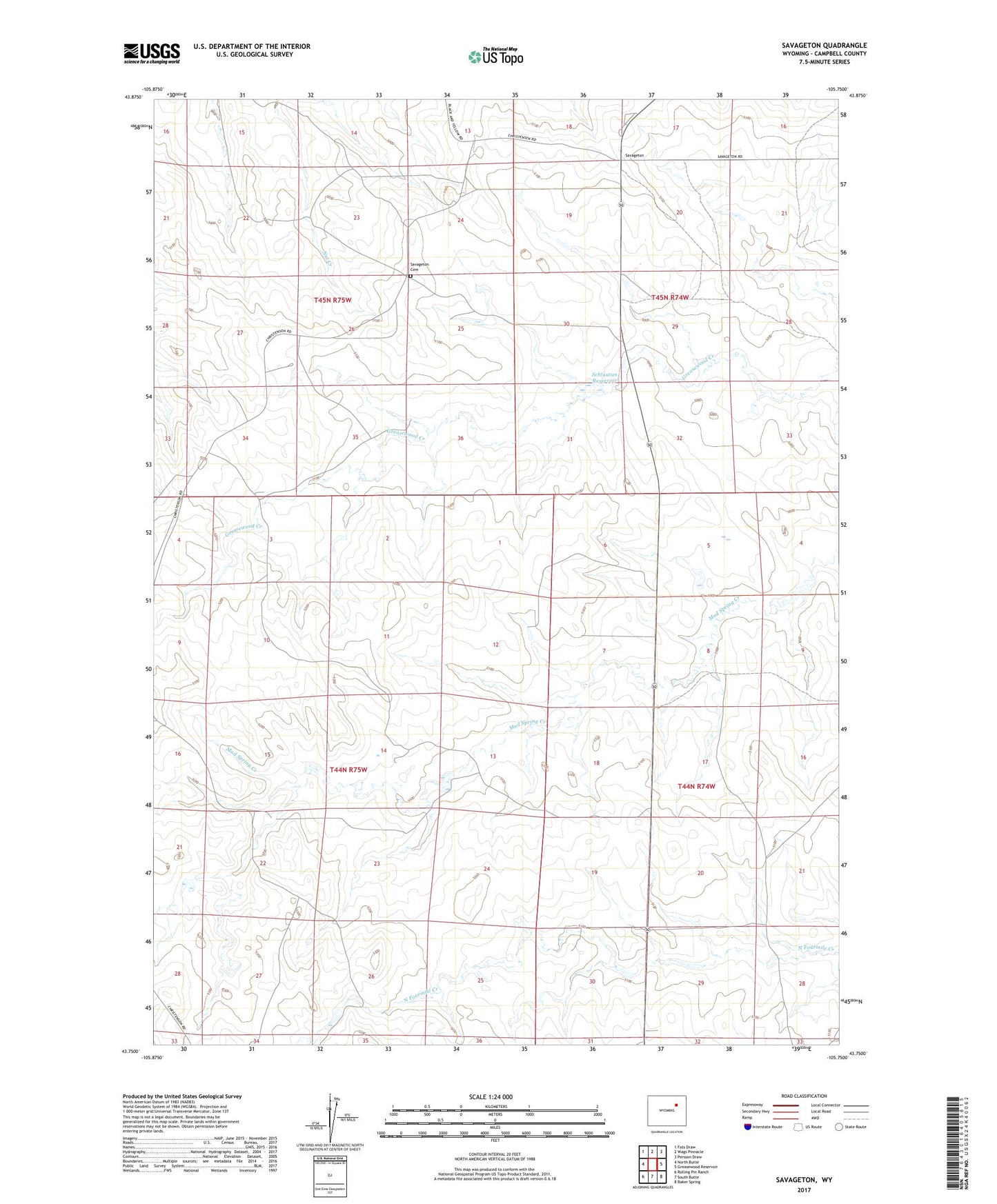
2021 topographic map quadrangle Savageton in the state of Wyoming. Scale: 1:24000. Based on the newly updated USGS 7.5' US Topo map series, this map is in the following counties: Campbell. The map contains contour data, water features, and other items you are used to seeing on USGS maps, but also has updated roads and other features. This is the next generation of topographic maps. Printed on high-quality waterproof paper with UV fade-resistant inks.
Quads adjacent to this one:
West: North Butte
Northwest: Fats Draw
North: Wags Pinnacle
Northeast: Persson Draw
East: Greasewood Reservoir
Southeast: Baker Spring
South: South Butte
Southwest: Rolling Pin Ranch
This map covers the same area as the classic USGS quad with code o43105g7.
Contains the following named places: Black Star Mine, Blue Star Number One Mine, Camblin Ranch, Gilbertz Ranch, H Schlautmann Ranch, Jeanette Mine, Jeanette Number One Mine, KM Number One Mine, Lauby Ranch, Little Star Mine, Mary Mine, Niles Ranch, Paula Number One Mine, Queen Number Two Mine, Savageton, Savageton Cemetery, Schlautan Reservoir, Schlautman Dam, Utah Mine, Van Eugenum Number One Mine, W Schlautmann Ranch, White Mule Mine