MyTopo
South Butte Wyoming US Topo Map
Couldn't load pickup availability
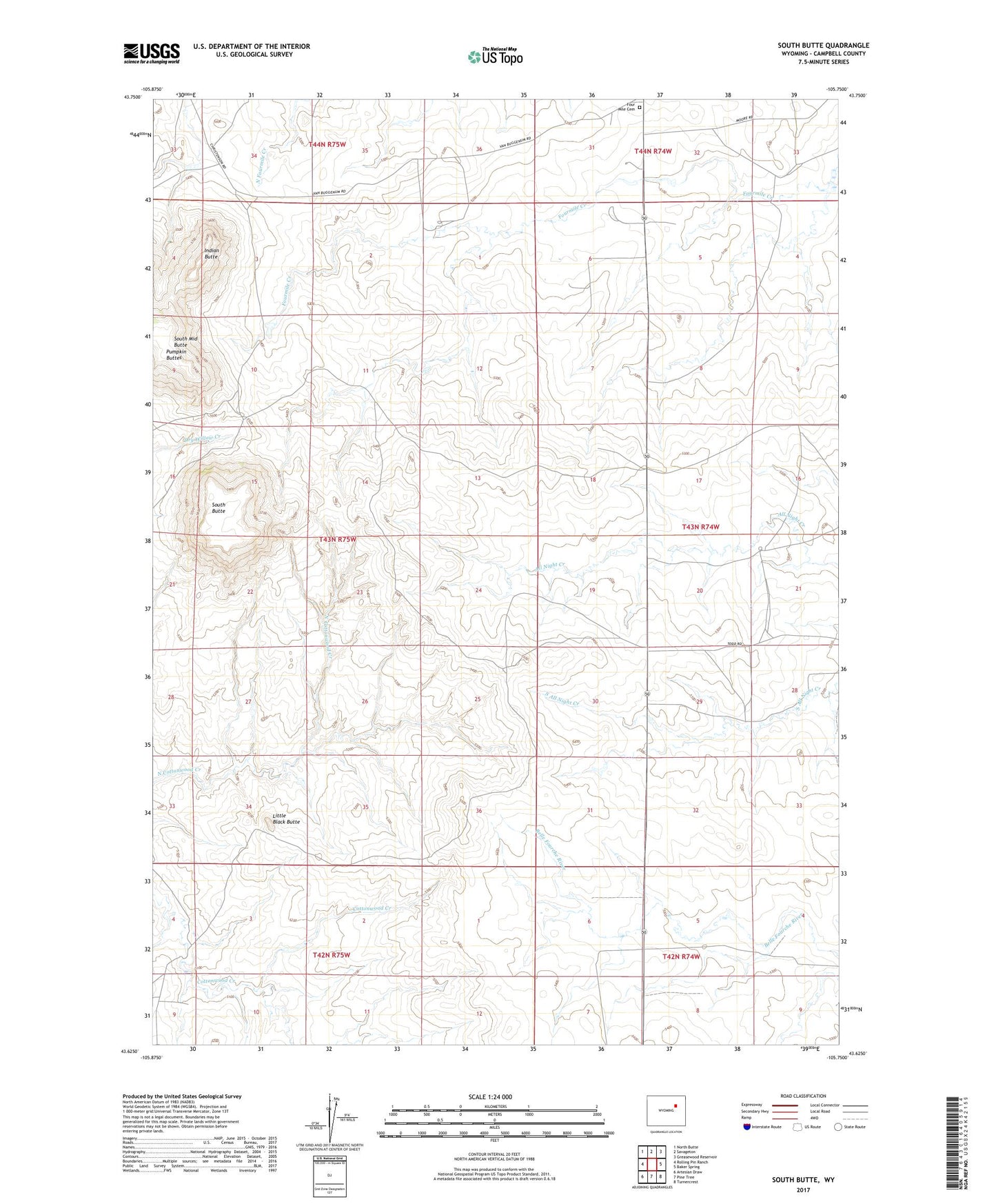
2021 topographic map quadrangle South Butte in the state of Wyoming. Scale: 1:24000. Based on the newly updated USGS 7.5' US Topo map series, this map is in the following counties: Campbell. The map contains contour data, water features, and other items you are used to seeing on USGS maps, but also has updated roads and other features. This is the next generation of topographic maps. Printed on high-quality waterproof paper with UV fade-resistant inks.
Quads adjacent to this one:
West: Rolling Pin Ranch
Northwest: North Butte
North: Savageton
Northeast: Greasewood Reservoir
East: Baker Spring
Southeast: Turnercrest
South: Pine Tree
Southwest: Artesian Draw
This map covers the same area as the classic USGS quad with code o43105f7.
Contains the following named places: Betty Number Twelve Mine, Brown Ranch, Cactus School, Campbin and West Mine, Fillbrink Fee Land Mine, Four Mile Cemetery, Hardin Ranch, Indian Butte, Little Black Butte, Pumpkin Buttes, Ruby Ranch, Sievers Ranch, South Butte, South Middle Butte, Syl Del Mine, Van Buggenem Ranch, Van Eugenum Number Two Mine, Wyo Roc Mine