MyTopo
Round Top Lake Wyoming US Topo Map
Couldn't load pickup availability
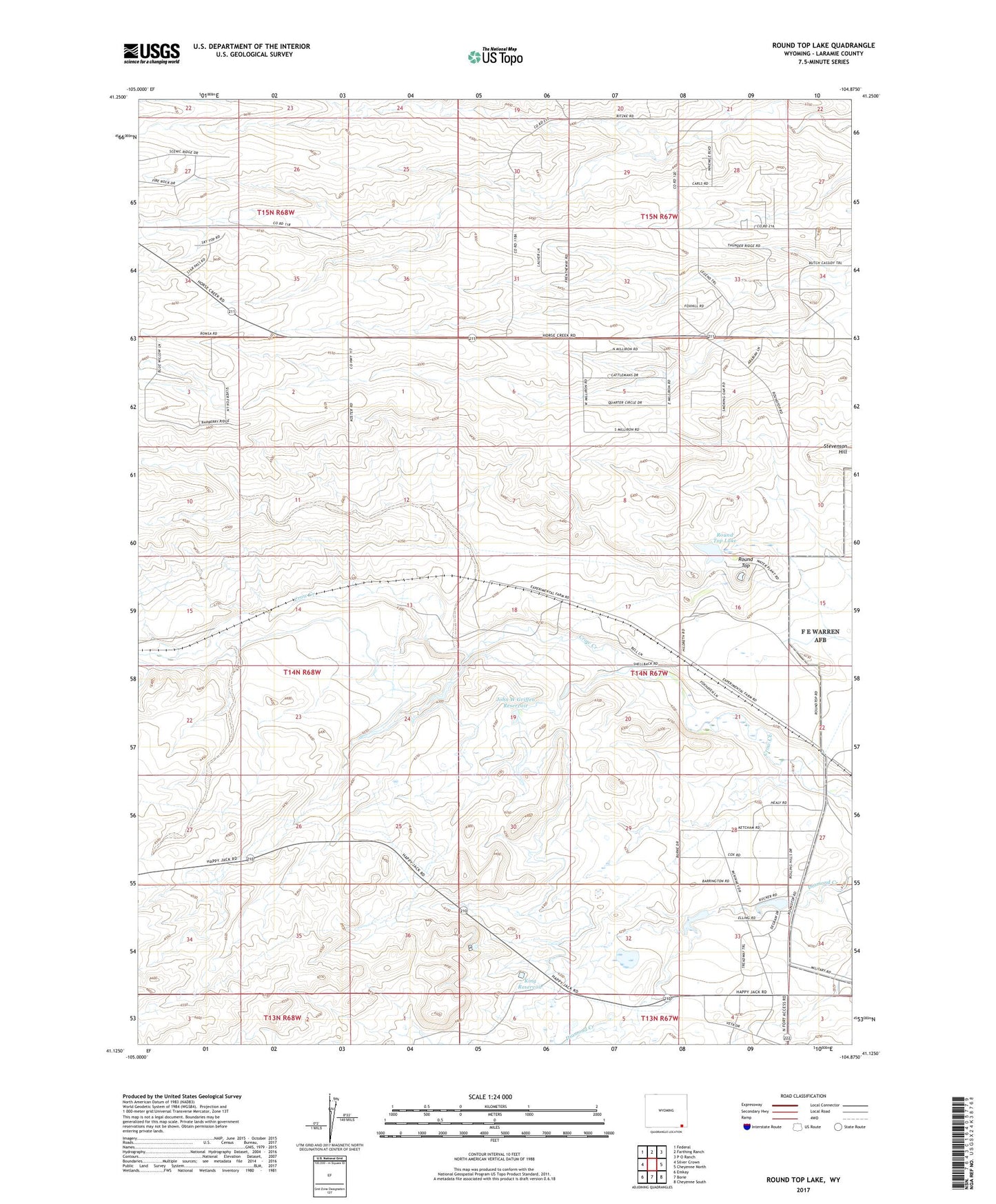
2021 topographic map quadrangle Round Top Lake in the state of Wyoming. Scale: 1:24000. Based on the newly updated USGS 7.5' US Topo map series, this map is in the following counties: Laramie. The map contains contour data, water features, and other items you are used to seeing on USGS maps, but also has updated roads and other features. This is the next generation of topographic maps. Printed on high-quality waterproof paper with UV fade-resistant inks.
Quads adjacent to this one:
West: Silver Crown
Northwest: Federal
North: Farthing Ranch
Northeast: P O Ranch
East: Cheyenne North
Southeast: Cheyenne South
South: Borie
Southwest: Emkay
Contains the following named places: Bailey Number 1 Well, Bailey Number 5 Well, Bell Number 10 Well, Bell Number 11 Well, Bell Number 12 Well, Bell Number 14 Well, Bell Number 15 Well, Bell Number 16 Well, Bell Number 17 Well, Bell Number 24 Well, Bell Number 25 Well, Bell Number 5 Well, Bell Number 6 Well, Bell Number 8 Well, Bell Ranch, Carpenter Mill Camp, Corriedale Ranch, Eddy Well, Elkar Number 1 Well, Elkar Number 3 Well, Experiment Station Dam, Fred Hersig Dam, Fred Hersig Reservoir, Happy Jack Number 1 Well, Happy Jack Number 2 Well, Happy Jack Number 3 Well, High Plains Grasslands Research Station, Holman Well, John W Griffen Dam, John W Griffen Reservoir, King Number 2 Well, King Number 4 Well, King Reservoir, KKTU-TV (Cheyenne), Koppes Number 1 Well, Koppes Number 2 Well, Koppes Number 3 Well, Koppes Number 4 Well, Meadowlark Ranch, Round Top, Round Top Lake, Shell Back Ranch, Shellback, Spring Creek, Wyoming Angus Ranch