MyTopo
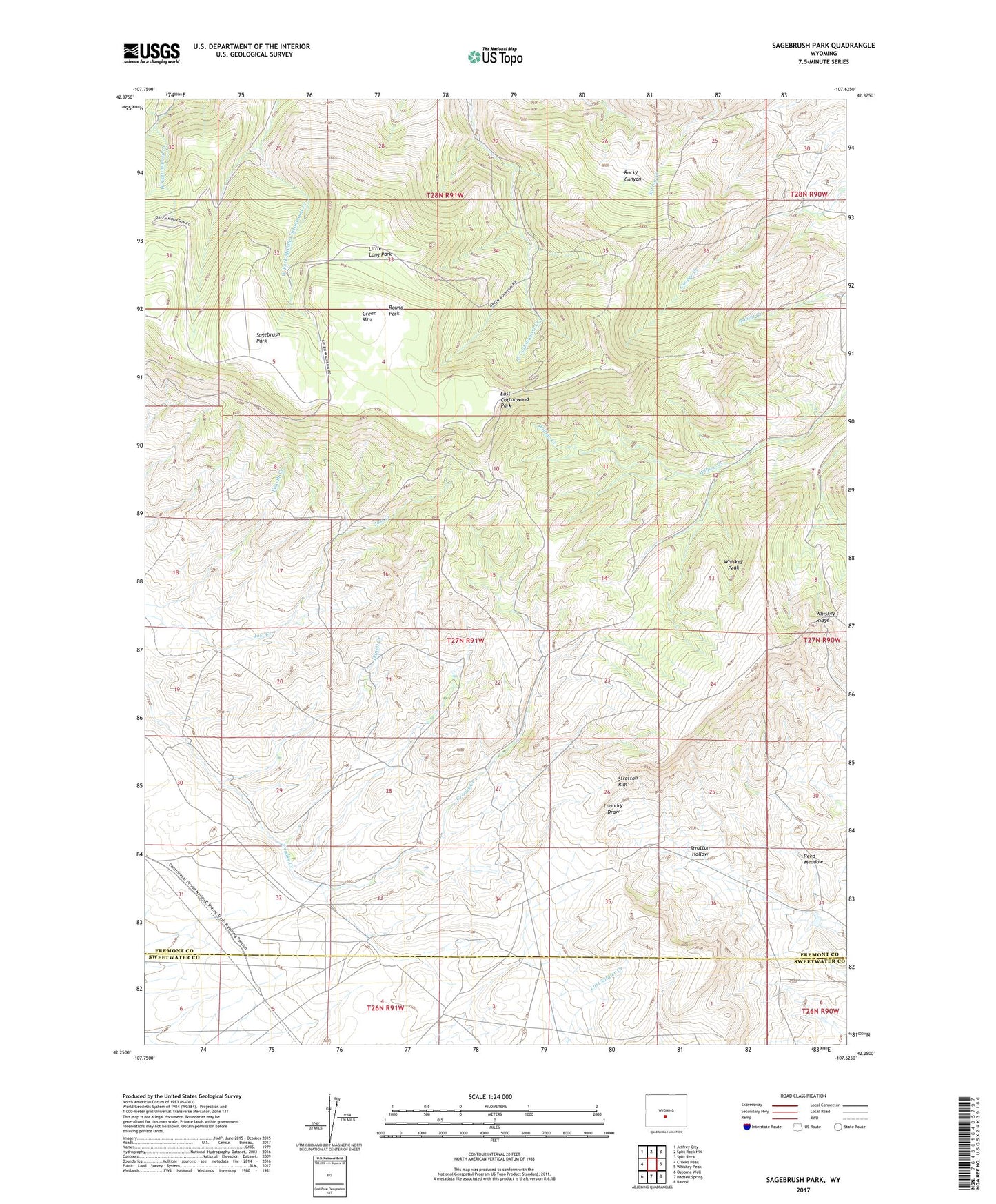
Sagebrush Park Wyoming US Topo Map
Couldn't load pickup availability
2021 topographic map quadrangle Sagebrush Park in the state of Wyoming. Scale: 1:24000. Based on the newly updated USGS 7.5' US Topo map series, this map is in the following counties: Fremont, Sweetwater. The map contains contour data, water features, and other items you are used to seeing on USGS maps, but also has updated roads and other features. This is the next generation of topographic maps. Printed on high-quality waterproof paper with UV fade-resistant inks.
Quads adjacent to this one:
West: Crooks Peak
Northwest: Jeffrey City
North: Split Rock NW
Northeast: Split Rock
East: Whiskey Peak
Southeast: Bairoil
South: Hadsell Spring
Southwest: Osborne Well
Contains the following named places: C and L Claims, Daniel Creek, Diehl Mine, East Cottonwood Park, Emily Mine, First Creek, Hadsell Ranch, Hays Mine, Heald Mine, Little Long Park, Loma Uranium Property Mine, Missed A Lick Number One Mine, Reed Meadow, Round Park, Sagebrush Park, Sandy Number One Mine, Stratton Hollow, Stratton Ranch, Stratton Rim, Whiskey Peak, Whiskey Ridge, Windblown Mine