MyTopo
Salt Creek Wyoming US Topo Map
Couldn't load pickup availability
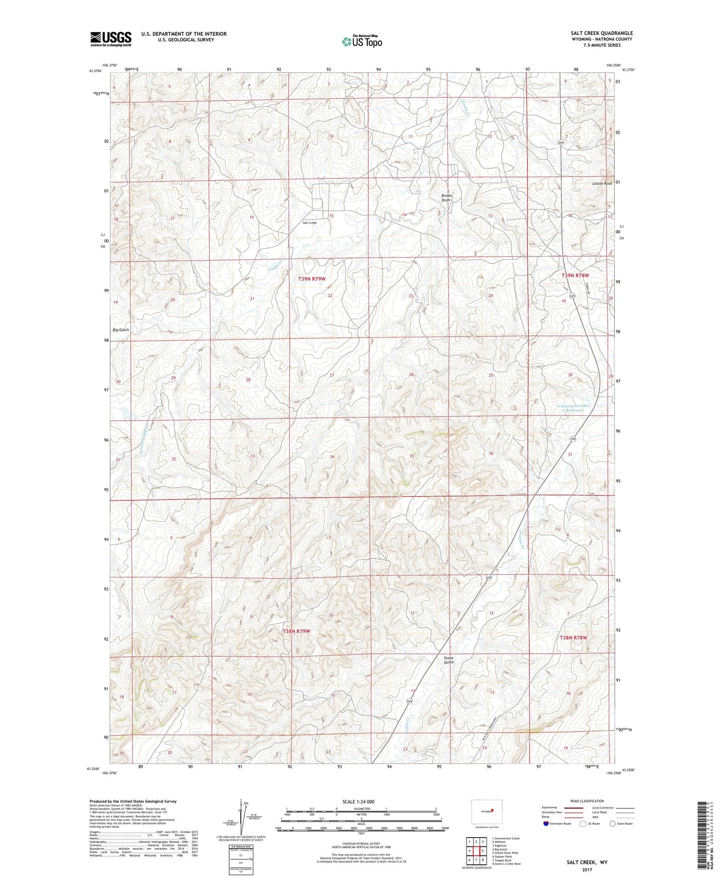
2021 topographic map quadrangle Salt Creek in the state of Wyoming. Scale: 1:24000. Based on the newly updated USGS 7.5' US Topo map series, this map is in the following counties: Natrona. The map contains contour data, water features, and other items you are used to seeing on USGS maps, but also has updated roads and other features. This is the next generation of topographic maps. Printed on high-quality waterproof paper with UV fade-resistant inks.
Quads adjacent to this one:
West: Big Gulch
Northwest: Government Creek
North: Midwest
Northeast: Edgerton
East: Gillam Draw West
Southeast: Seven L Creek West
South: Teapot Rock
Southwest: Statzer Point
This map covers the same area as the classic USGS quad with code o43106c3.
Contains the following named places: Brown Draw, Casper Mountain Asbestos Deposits, Castle Rock, Consolidated Number 3 Dam, Consolidated Reservoir Number 3, Fensland Number 2 Dam, Fensland Number 2 Reservoir, Midwest Number 12 Dam, Salt Creek, Snyder Dam, Snyder Reservoir, South Fork Castle Creek, Stove Gulch, Trigood Camp