MyTopo
Gillam Draw West Wyoming US Topo Map
Couldn't load pickup availability
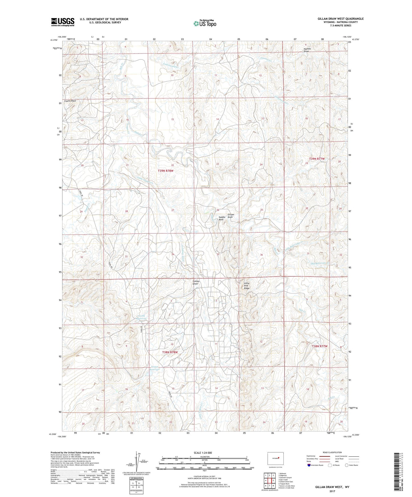
2021 topographic map quadrangle Gillam Draw West in the state of Wyoming. Scale: 1:24000. Based on the newly updated USGS 7.5' US Topo map series, this map is in the following counties: Natrona. The map contains contour data, water features, and other items you are used to seeing on USGS maps, but also has updated roads and other features. This is the next generation of topographic maps. Printed on high-quality waterproof paper with UV fade-resistant inks.
Quads adjacent to this one:
West: Salt Creek
Northwest: Midwest
North: Edgerton
Northeast: Sawmill Canyon
East: Gillam Draw East
Southeast: Seven L Creek East
South: Seven L Creek West
Southwest: Teapot Rock
This map covers the same area as the classic USGS quad with code o43106c2.
Contains the following named places: Big Bull Cedar Creek, C B Richardson Dam, C B Richardson Number 1 Reservoir, Conley Dam, Conley Draw, Conley Reservoir, East Teapot Dome Oil Field, Gillam Draw, Holmes Draw, Jimmies Creek, Little Bull Cedar Creek, Little Pine Ridge, Little Teapot Creek, Naval Petroleum Reserve Number 3, S C Pryor Number 1 Dam, S C Pryor Number 1 Reservoir, Saddle Rock, Teapot Creek, Teapot Dam, Teapot Reservoir