MyTopo
Schlicht Draw Wyoming US Topo Map
Couldn't load pickup availability
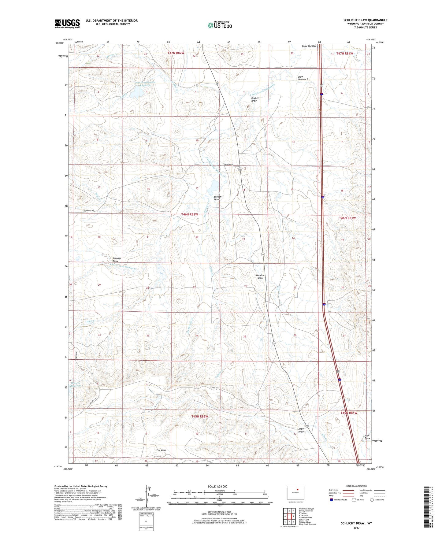
2021 topographic map quadrangle Schlicht Draw in the state of Wyoming. Scale: 1:24000. Based on the newly updated USGS 7.5' US Topo map series, this map is in the following counties: Johnson. The map contains contour data, water features, and other items you are used to seeing on USGS maps, but also has updated roads and other features. This is the next generation of topographic maps. Printed on high-quality waterproof paper with UV fade-resistant inks.
Quads adjacent to this one:
West: The Horn
Northwest: Robinson Canyon
North: Purdy Reservoir
Northeast: Trabing
East: Antelope Draw
Southeast: Dry Creek Reservoir
South: Hibbard Draw
Southwest: Mayoworth
Contains the following named places: Beaver Creek, Beaver Tooth Ditch, Caley Creek, Corpe Draw, Draw Number 2, Gosney Ranch, Horn Creek, Horn Creek Dam, Horn Creek Reservoir, Horn Dam, Horn Reservoir, Houston Draw, Knebel Draw, Pole Creek, Pole Creek Irrigation Dam, Pole Creek Irrigation Reservoir, Schlicht Draw, Seepage Draw, South Fork Dam, South Fork Reservoir, Steel Creek, Tex Springs Creek