MyTopo
Seely Wyoming US Topo Map
Couldn't load pickup availability
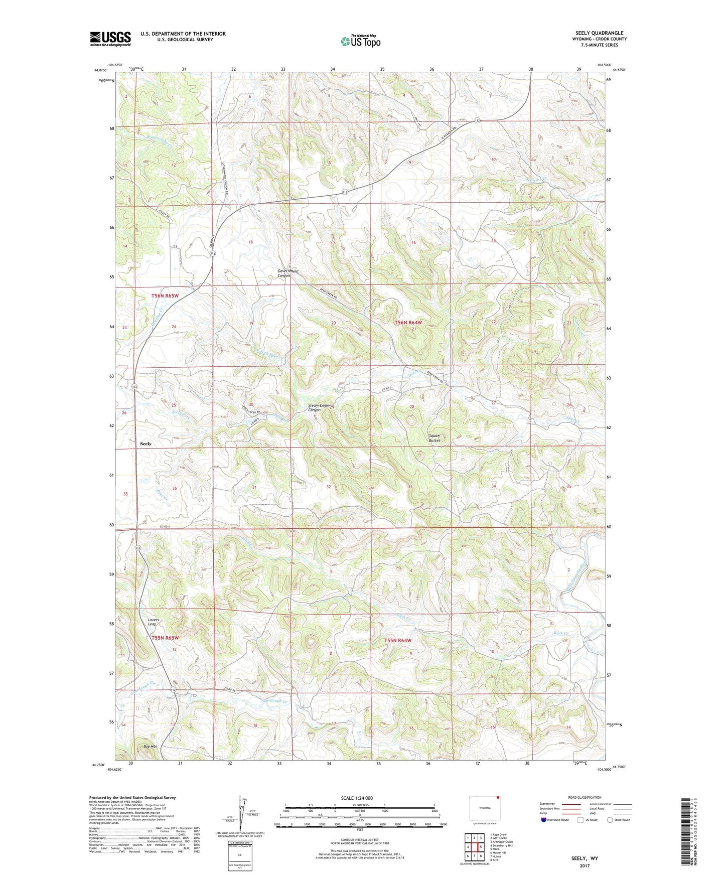
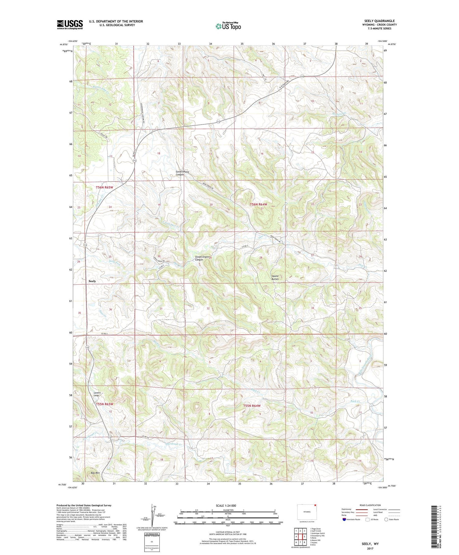
2021 topographic map quadrangle Seely in the state of Wyoming. Scale: 1:24000. Based on the newly updated USGS 7.5' US Topo map series, this map is in the following counties: Crook. The map contains contour data, water features, and other items you are used to seeing on USGS maps, but also has updated roads and other features. This is the next generation of topographic maps. Printed on high-quality waterproof paper with UV fade-resistant inks.
Quads adjacent to this one:
West: Strawberry Hill
Northwest: Page Draw
North: Gaff Creek
Northeast: Antelope Gulch
East: Mona
Southeast: Alva
South: Hulett
Southwest: Moore Hill
Contains the following named places: Ballou Ranch, Bay Mountain, Bay Ranch, Bear Creek, Belle Ranch, Buck Creek, Cedar Creek Number One Mine, Clark Radar Bomb Scoring Site, Davidson Property Mine, Dry Doe Creek, Hulett Division, Jay School, Johnson School, Lee Ranch, Lovers Leap, Nielsen Ranch, North Fork Deer Creek, Pearson Ranch, Seely, Seely Fork, Squaw Buttes, Steam Engine Canyon