MyTopo
Duling Hill Wyoming US Topo Map
Couldn't load pickup availability
Also explore the Duling Hill Forest Service Topo of this same quad for updated USFS data
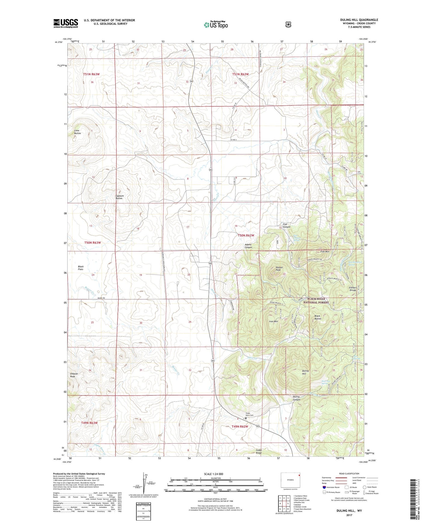
2021 topographic map quadrangle Duling Hill in the state of Wyoming. Scale: 1:24000. Based on the newly updated USGS 7.5' US Topo map series, this map is in the following counties: Crook. The map contains contour data, water features, and other items you are used to seeing on USGS maps, but also has updated roads and other features. This is the next generation of topographic maps. Printed on high-quality waterproof paper with UV fade-resistant inks.
Quads adjacent to this one:
West: Pfeiffer Hill
Northwest: Sundance West
North: Sundance East
Northeast: Red Canyon Creek
East: Moskee
Southeast: Dry Draw
South: Inyan Kara Mountain
Southwest: Sheldon Creek
This map covers the same area as the classic USGS quad with code o44104c3.
Contains the following named places: Adams Canyon, Bear Den Spring, Black Butte Deposit Mine, Black Buttes, Black Flats, Boardinghouse Creek, Boardinghouse Spring, Den Spring, Duling Canyon, Duling Hill, Elkhorn Divide, Fish Canyon, Fish Canyon Spring, Fish Mountain, Gypsum Buttes, Hooker Peak, Inyan Kara Cemetery, Iron Mountain, Lime Buttes, Spring Creek, ZIP Code: 82729