MyTopo
Shell Falls Wyoming US Topo Map
Couldn't load pickup availability
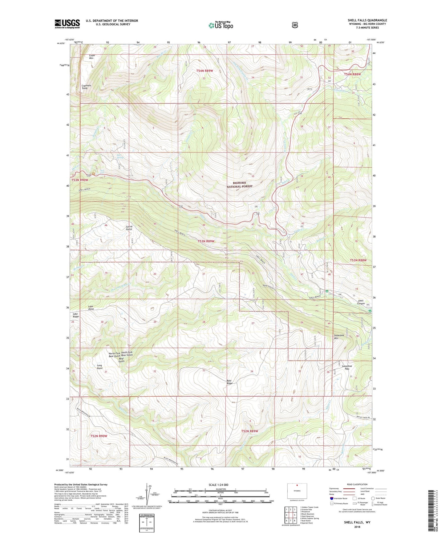
2021 topographic map quadrangle Shell Falls in the state of Wyoming. Scale: 1:24000. Based on the newly updated USGS 7.5' US Topo map series, this map is in the following counties: Big Horn. The map contains contour data, water features, and other items you are used to seeing on USGS maps, but also has updated roads and other features. This is the next generation of topographic maps. Printed on high-quality waterproof paper with UV fade-resistant inks.
Quads adjacent to this one:
West: Black Mountain
Northwest: Hidden Tepee Creek
North: Granite Pass
Northeast: Woodrock
East: Shell Reservoir
Southeast: Spanish Point
South: Bush Butte
Southwest: White Sulphur Spring
Contains the following named places: Bald Ridge, Bench Trail, Bighorn Ski Area, Brindle Creek, Bull Springs, Cabin Creek, Cabin Creek Campground, Copmans Tomb, Cry Creek, Dry Fork Granite Creek, Granite Creek, Granite Creek Campground, Granite Greek Picnic Ground, Grouse Creek, Lake Ridge, Long Point, North Fork Bear Gulch, Ranger Creek, Ruble Creek, Salt Creek, Shell Creek Campground, Shell Creek Ranger Station, Shell Falls, Shell Falls Observation Point, Snowshoe Mountain, Snowshoe Pass, South Fork Bear Gulch, Whaley Ditch