MyTopo
Shell Reservoir Wyoming US Topo Map
Couldn't load pickup availability
Also explore the Shell Reservoir Forest Service Topo of this same quad for updated USFS data
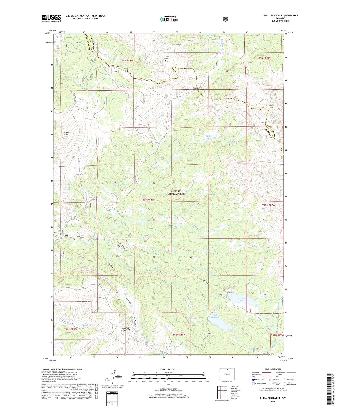
2021 topographic map quadrangle Shell Reservoir in the state of Wyoming. Scale: 1:24000. Based on the newly updated USGS 7.5' US Topo map series, this map is in the following counties: Big Horn, Sheridan. The map contains contour data, water features, and other items you are used to seeing on USGS maps, but also has updated roads and other features. This is the next generation of topographic maps. Printed on high-quality waterproof paper with UV fade-resistant inks.
Quads adjacent to this one:
West: Shell Falls
Northwest: Granite Pass
North: Woodrock
Northeast: Walker Mountain
East: Dome Lake
Southeast: Shell Lake
South: Spanish Point
Southwest: Bush Butte
This map covers the same area as the classic USGS quad with code o44107e4.
Contains the following named places: Adelaide Creek, Adelaide Dam, Adelaide Lake, Adelaide Reservoir, Adelaide Trail, Antelope Butte, Antelope Creek, Bruce Mountain, Bruce Mountain Lake, Buckley Creek, Calvin Lake, Crooked Creek, Crooked Creek Hill, Dome Peak, Lake Arden, Mail Creek, McKinnon Creek, Moraine Creek, Mud Lake, Ranger Creek Campground, Ranger Creek Ranch, Shell Dam, Shell Reservoir, Willett Creek, Willett Lake, Woodchuck Pass