MyTopo
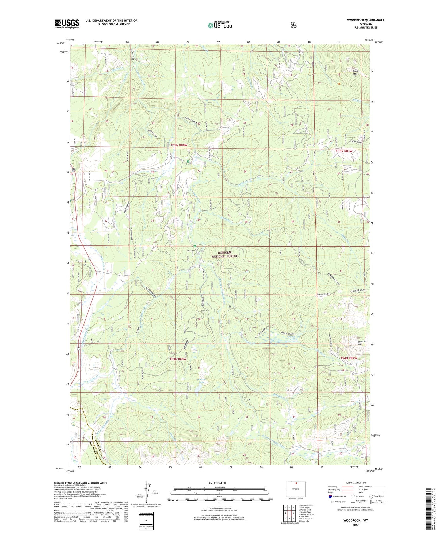
Woodrock Wyoming US Topo Map
Couldn't load pickup availability
Also explore the Woodrock Forest Service Topo of this same quad for updated USFS data
2021 topographic map quadrangle Woodrock in the state of Wyoming. Scale: 1:24000. Based on the newly updated USGS 7.5' US Topo map series, this map is in the following counties: Sheridan, Big Horn. The map contains contour data, water features, and other items you are used to seeing on USGS maps, but also has updated roads and other features. This is the next generation of topographic maps. Printed on high-quality waterproof paper with UV fade-resistant inks.
Quads adjacent to this one:
West: Granite Pass
Northwest: Burgess Junction
North: Skull Ridge
Northeast: Dayton South
East: Walker Mountain
Southeast: Dome Lake
South: Shell Reservoir
Southwest: Shell Falls
This map covers the same area as the classic USGS quad with code o44107f4.
Contains the following named places: Black Mountain, Bonanza Creek, Bruce Creek, Compartment Creek, Copper Creek, Dead Swede Campgound, Dry Owen Creek, Duncan Lake, East Fork South Tongue River, East Woodrock Campground, Graves Creek, Graves Lake, Lookout Mountain, Mohawk Creek, Owen Creek, Padlock Cow Camp, Prospect Creek, Sheeley Creek, Sucker Creek, Taylor Mine, Tie Flume Campground, West Fork South Tongue River, West Woodrock Campground, Woodchuck Creek, Woodrock Guard Station