MyTopo
Shepard Reservoir Wyoming US Topo Map
Couldn't load pickup availability
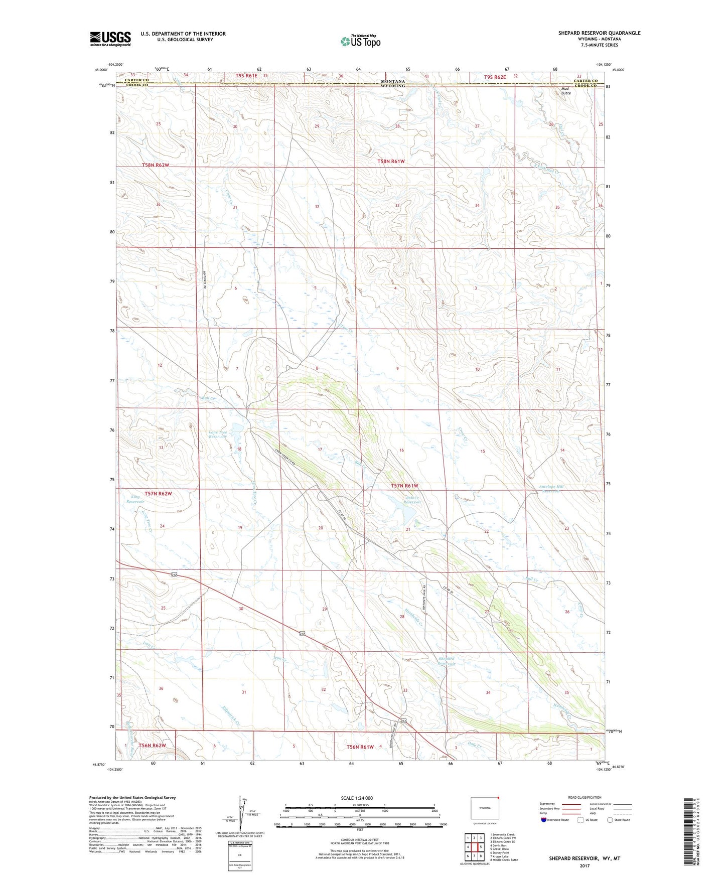
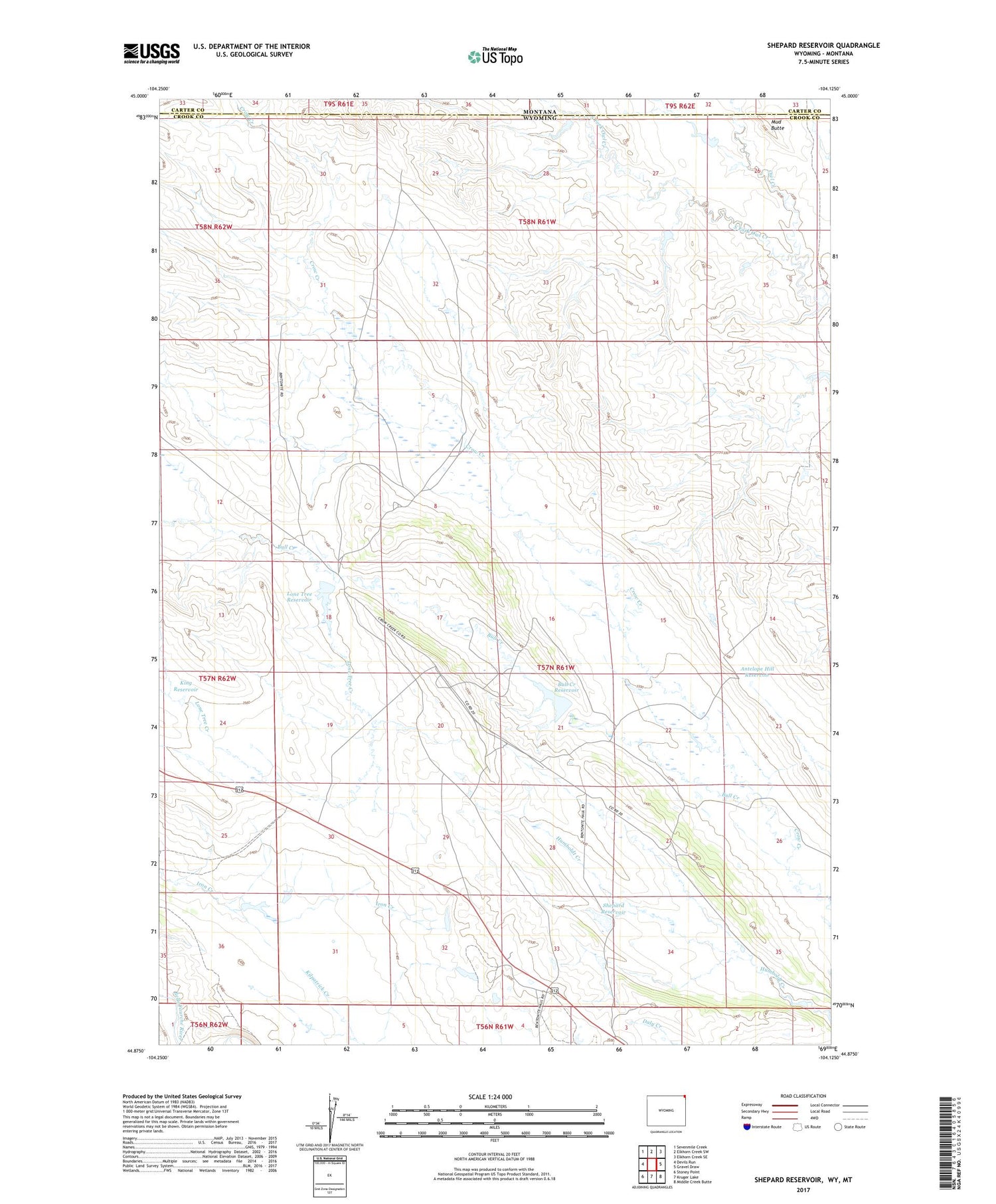
2021 topographic map quadrangle Shepard Reservoir in the state of Wyoming. Scale: 1:24000. Based on the newly updated USGS 7.5' US Topo map series, this map is in the following counties: Crook, Carter. The map contains contour data, water features, and other items you are used to seeing on USGS maps, but also has updated roads and other features. This is the next generation of topographic maps. Printed on high-quality waterproof paper with UV fade-resistant inks.
Quads adjacent to this one:
West: Devils Run
Northwest: Sevenmile Creek
North: Elkhorn Creek SW
Northeast: Elkhorn Creek SE
East: Gravel Draw
Southeast: Middle Creek Butte
South: Kruger Lake
Southwest: Stoney Point
Contains the following named places: Antelope Hill Dam, Antelope Hill Reservoir, Bull Creek, Bull Creek Dam, Bull Creek Reservoir, Colony Mine, Colony Radar Bomb Scoring Site, Crago Ranch, Crow Creek Dam, Crow Creek Mine, Crow Creek Reservoir, King Dam, King Reservoir, Lone Tree Creek, Lone Tree Dam, Lone Tree Reservoir, Mud Butte, Newland Ranch, Raber Ranch, Shepard Reservoir, South Fork Owl Creek, Strawberry Hill Dam, Strawberry Hill Reservoir