MyTopo
Middle Creek Butte South Dakota US Topo Map
Couldn't load pickup availability
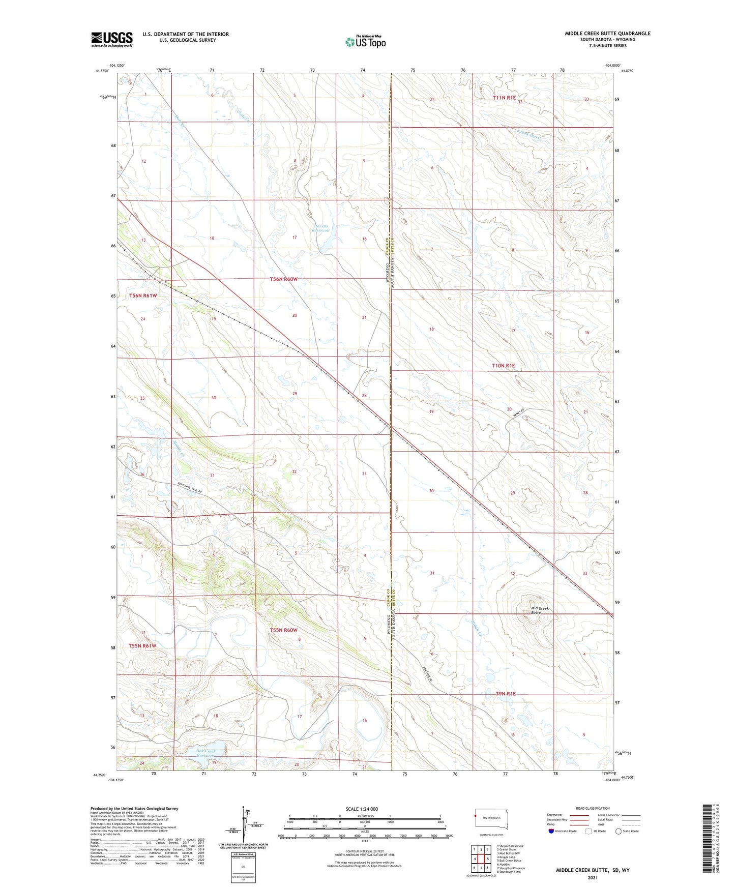
2021 topographic map quadrangle Middle Creek Butte in the states of Wyoming, South Dakota. Scale: 1:24000. Based on the newly updated USGS 7.5' US Topo map series, this map is in the following counties: Butte, Crook. The map contains contour data, water features, and other items you are used to seeing on USGS maps, but also has updated roads and other features. This is the next generation of topographic maps. Printed on high-quality waterproof paper with UV fade-resistant inks.
Quads adjacent to this one:
West: Kruger Lake
Northwest: Shepard Reservoir
North: Gravel Draw
Northeast: Mud Buttes NW
East: Bull Creek Butte
Southeast: Sourdough Flats
South: Slaughter Reservoir
Southwest: Aladdin
Contains the following named places: Belle Fourche River Number Three Mine, Chicago Creek, Daly Creek, Dennis Dam, Dennis Reservoir, Ghost Creek, Havens Dam, Havens Reservoir, Humboldt Creek, McLeod Ranch, Middle Creek Butte, Middle Creek Number One Mine, Middle Creek Number Two Mine, Oak Creek, Oak Creek Reservoir, Tope Ranch, VVV Ranch