MyTopo
Sherrill Hills Wyoming US Topo Map
Couldn't load pickup availability
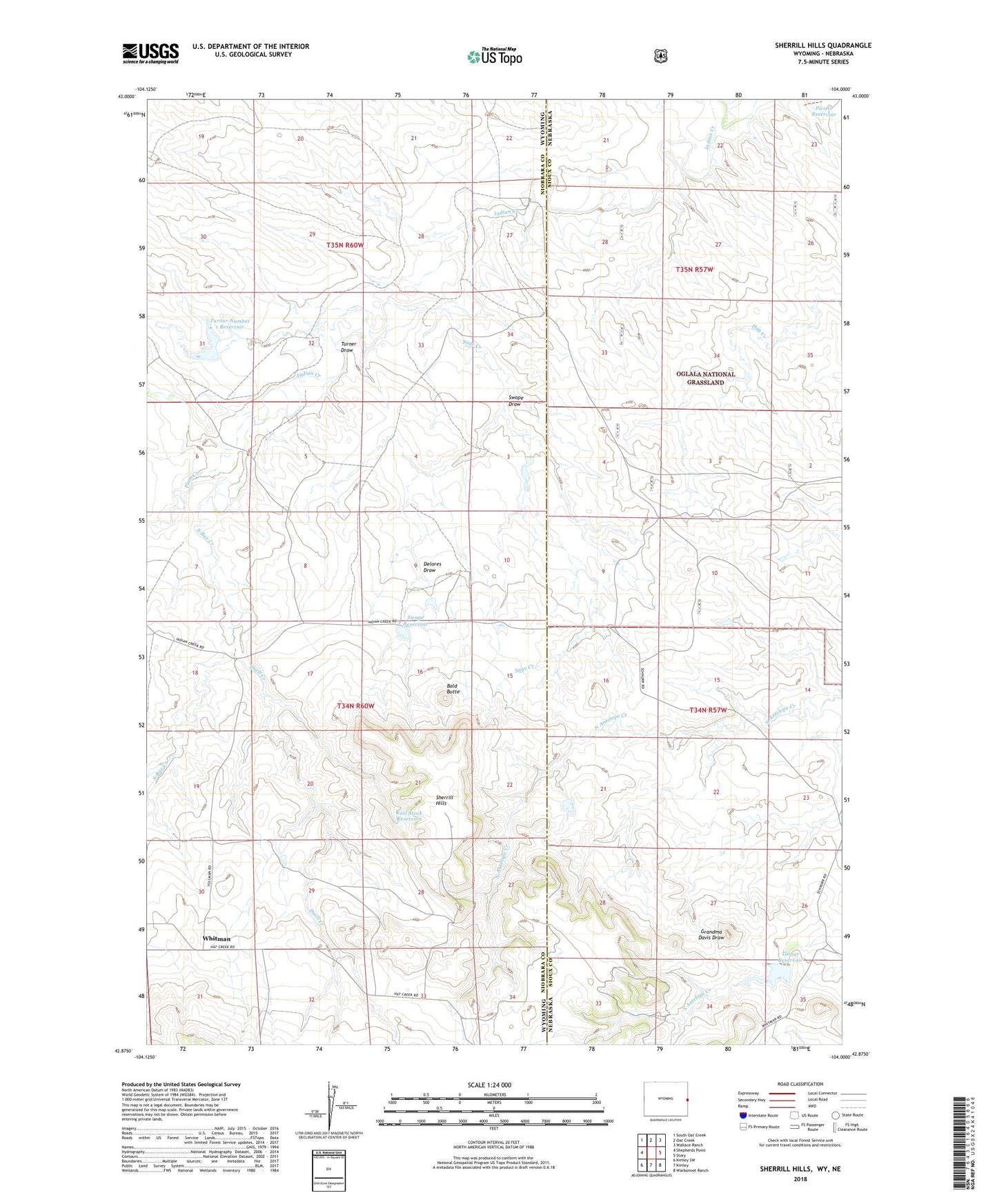
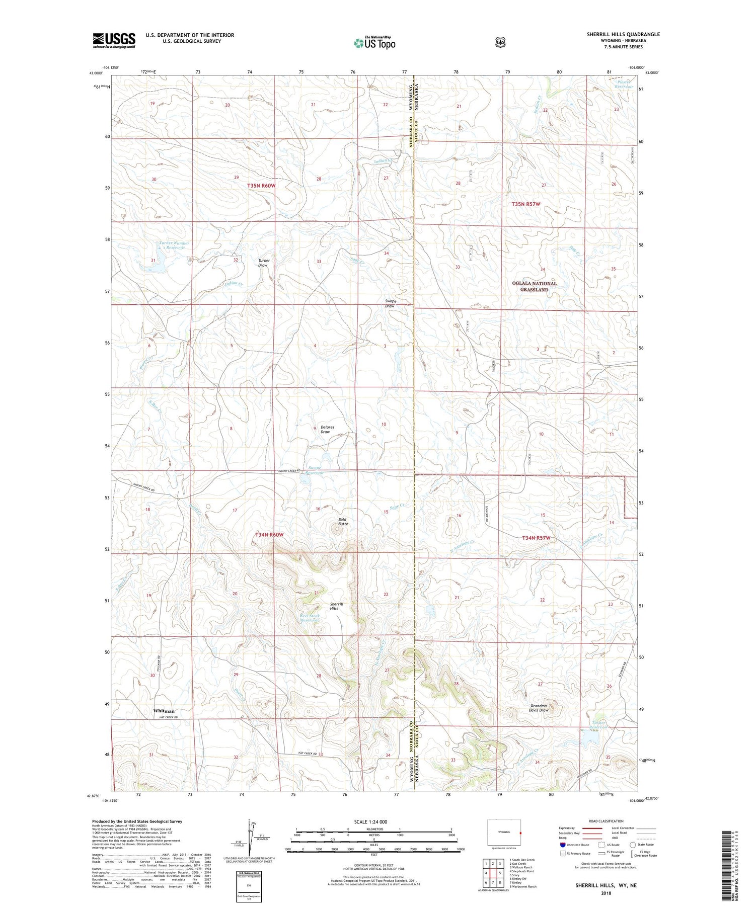
2021 topographic map quadrangle Sherrill Hills in the states of Wyoming, Nebraska. Scale: 1:24000. Based on the newly updated USGS 7.5' US Topo map series, this map is in the following counties: Niobrara, Sioux. The map contains contour data, water features, and other items you are used to seeing on USGS maps, but also has updated roads and other features. This is the next generation of topographic maps. Printed on high-quality waterproof paper with UV fade-resistant inks.
Quads adjacent to this one:
West: Shepherds Point
Northwest: South Oat Creek
North: Oat Creek
Northeast: Wallace Ranch
East: Story
Southeast: Warbonnet Ranch
South: Kirtley
Southwest: Kirtley SW
Contains the following named places: Bald Butte, Delores Draw, Dolores Number 1 Reservoir, Duell Creek, Keel Dam, Keel Stock Reservoir, Piester Dam, Piester Reservoir, Plum Creek, Sage Creek, S-Bar Creek, Sherrill Hills, Story Number 1 Dam, Story Number 1 Reservoir, Swope Dam, Swope Draw, Swope Number 2 Dam, Swope Number 2 Reservoir, Swope Reservoir, Turner Dam, Turner Draw, Turner Number 1 Dam, Turner Number 1 Reservoir, Turner Reservoir, Whitman