MyTopo
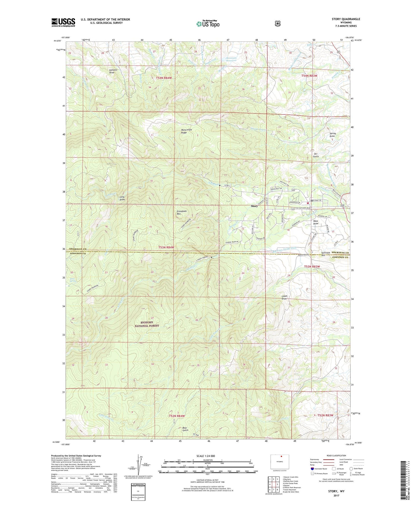
Story Wyoming US Topo Map
Couldn't load pickup availability
Also explore the Story Forest Service Topo of this same quad for updated USFS data
2021 topographic map quadrangle Story in the state of Wyoming. Scale: 1:24000. Based on the newly updated USGS 7.5' US Topo map series, this map is in the following counties: Sheridan, Johnson. The map contains contour data, water features, and other items you are used to seeing on USGS maps, but also has updated roads and other features. This is the next generation of topographic maps. Printed on high-quality waterproof paper with UV fade-resistant inks.
Quads adjacent to this one:
West: Little Goose Peak
Northwest: Beaver Creek Hills
North: Big Horn
Northeast: Buffalo Run Creek
East: Banner
Southeast: Lake De Smet West
South: Stone Mountain
Southwest: Willow Park Reservoir
This map covers the same area as the classic USGS quad with code o44106e8.
Contains the following named places: Bard Spring, Big Piney Divide Ditch, Gin Creek, Grandmas Mountain, KGK Tower, KLGT-FM (Buffalo), Little Falls Claim Mine, Long Draw, Meade Coffeen Ditch, Moncreiffe Dam, Moncreiffe Reservoir, Moncreiffe Ridge, Mountain Reservoir, Prairie Dog Kruse Ditch, Spring Creek, Story, Story Census Designated Place, Story Penrose Trail, Story Post Office, Story School, Story Volunteer Fire and Rescue, Thorn Rider Camp, Wagon Box, Wagon Box Battle Monument, ZIP Code: 82842