MyTopo
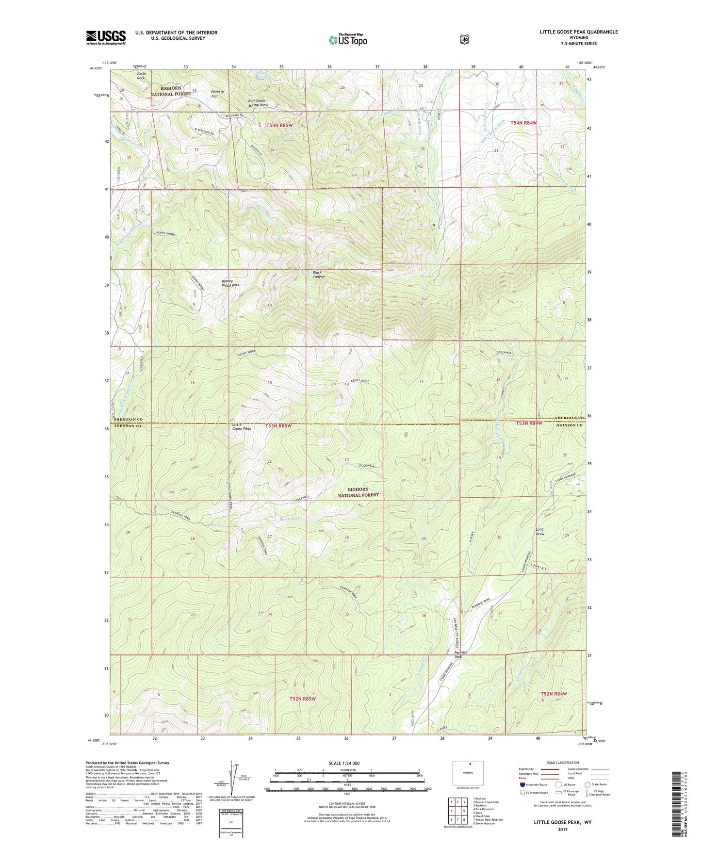
Little Goose Peak Wyoming US Topo Map
Couldn't load pickup availability
Also explore the Little Goose Peak Forest Service Topo of this same quad for updated USFS data
2021 topographic map quadrangle Little Goose Peak in the state of Wyoming. Scale: 1:24000. Based on the newly updated USGS 7.5' US Topo map series, this map is in the following counties: Sheridan, Johnson. The map contains contour data, water features, and other items you are used to seeing on USGS maps, but also has updated roads and other features. This is the next generation of topographic maps. Printed on high-quality waterproof paper with UV fade-resistant inks.
Quads adjacent to this one:
West: Park Reservoir
Northwest: Beckton
North: Beaver Creek Hills
Northeast: Big Horn
East: Story
Southeast: Stone Mountain
South: Willow Park Reservoir
Southwest: Cloud Peak
This map covers the same area as the classic USGS quad with code o44107e1.
Contains the following named places: Black Canyon, Bosin Rock, East Fork Little Goose Creek, Fordyce Tepee Number 1 Dam, Fordyce Tepee Number 1 Reservoir, Gallatin Cow Camp, Hilman Creek, Kinney Wood Park, KRBQ-TV (Sheridan), KSGW-TV (Sheridan), Little Goose Campground, Little Goose Peak, Mills Creek, Penrose Guard Station, Penrose Park, Penrose Park Trail, Poverty Flat, Red Grade Spring, Red Hill Ditch, Stockwell Creek, Stockwell Trail, Tepee Creek, West Fork Little Goose Creek, ZIP Code: 82833