MyTopo
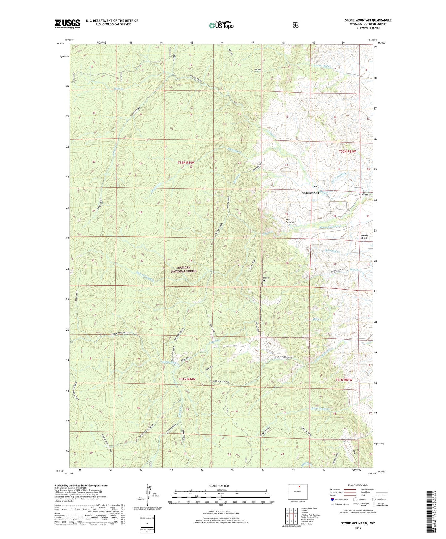
Stone Mountain Wyoming US Topo Map
Couldn't load pickup availability
Also explore the Stone Mountain Forest Service Topo of this same quad for updated USFS data
2021 topographic map quadrangle Stone Mountain in the state of Wyoming. Scale: 1:24000. Based on the newly updated USGS 7.5' US Topo map series, this map is in the following counties: Johnson. The map contains contour data, water features, and other items you are used to seeing on USGS maps, but also has updated roads and other features. This is the next generation of topographic maps. Printed on high-quality waterproof paper with UV fade-resistant inks.
Quads adjacent to this one:
West: Willow Park Reservoir
Northwest: Little Goose Peak
North: Story
Northeast: Banner
East: Lake De Smet West
Southeast: North Ridge
South: Hunter Mesa
Southwest: Lake Angeline
This map covers the same area as the classic USGS quad with code o44106d8.
Contains the following named places: Balm of Gilead Creek, Bud Love Big Game Winter Range, Ditch Creek, H F Bar Ranch, Jim Crow Ditch, Keno Creek, Middle Rock Creek, Mowry Basin Ditch, North Rock Creek, North Rock Creek Mine, Pheasant Creek, Red Canyon, Saddlestring, Saddlestring Community Post Office, Saddlestring Post Office, South Rock Creek, Spring Creek, Stone Mountain, The Speedway