MyTopo
Sunshine Reservoir Wyoming US Topo Map
Couldn't load pickup availability
Also explore the Sunshine Reservoir Forest Service Topo of this same quad for updated USFS data
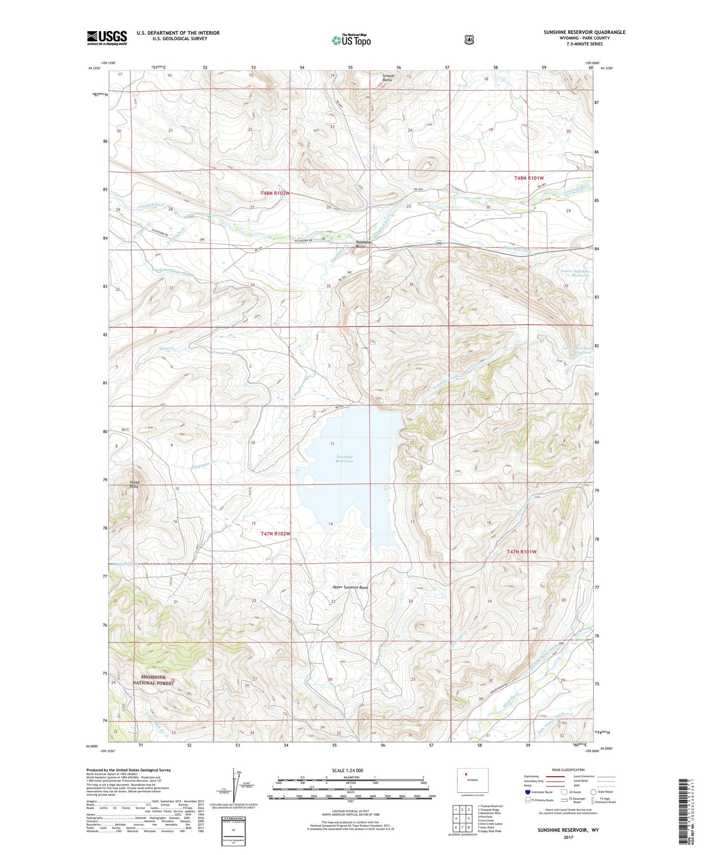
2021 topographic map quadrangle Sunshine Reservoir in the state of Wyoming. Scale: 1:24000. Based on the newly updated USGS 7.5' US Topo map series, this map is in the following counties: Park. The map contains contour data, water features, and other items you are used to seeing on USGS maps, but also has updated roads and other features. This is the next generation of topographic maps. Printed on high-quality waterproof paper with UV fade-resistant inks.
Quads adjacent to this one:
West: Pitchfork
Northwest: Thomas Reservoir
North: Tonopah Ridge
Northeast: Meeteetse West
East: Iron Creek
Southeast: Soapy Dale Peak
South: Noon Point
Southwest: Dick Creek Lakes
This map covers the same area as the classic USGS quad with code o44109a1.
Contains the following named places: Butte Ditch, East Timber Creek, Enlargement Upper Sunshine Dam, Enlargement Upper Sunshine Reservoir, Orrs Mine, Palette Ranch, Pappapau Butte, Pappapau Creek, Paradise Creek, Pitchfork Oil Field, Pitchfork Ranch, Schaub Butte, Sheep Creek, Sheep Point, Sunshine Basin Ditch, Sunshine Reservoir, Sunshine Supply Ditch, Upper Sunshine Basin, West Timber Creek, ZIP Code: 82433