MyTopo
Soapy Dale Peak Wyoming US Topo Map
Couldn't load pickup availability
Also explore the Soapy Dale Peak Forest Service Topo of this same quad for updated USFS data
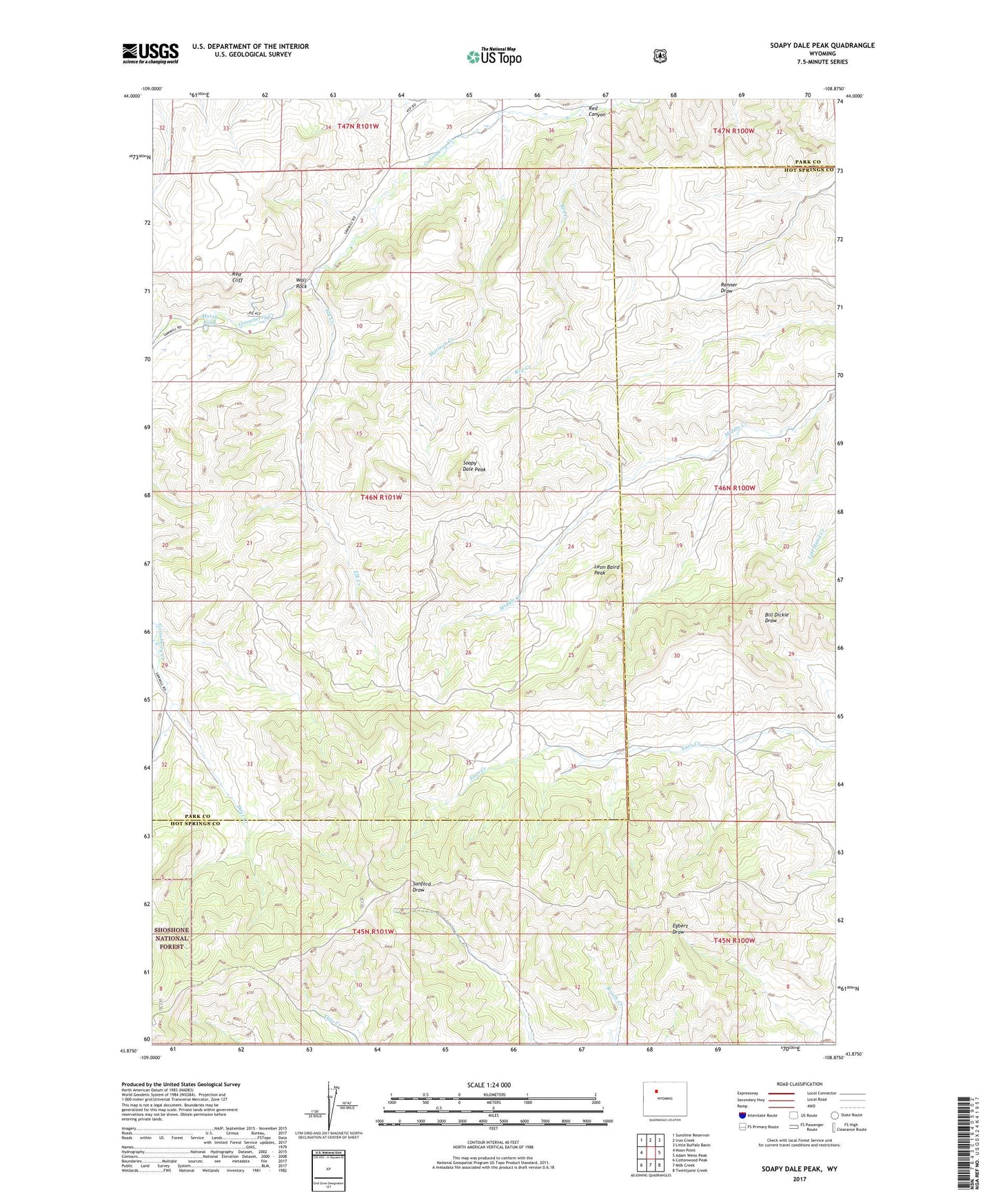
2021 topographic map quadrangle Soapy Dale Peak in the state of Wyoming. Scale: 1:24000. Based on the newly updated USGS 7.5' US Topo map series, this map is in the following counties: Hot Springs, Park. The map contains contour data, water features, and other items you are used to seeing on USGS maps, but also has updated roads and other features. This is the next generation of topographic maps. Printed on high-quality waterproof paper with UV fade-resistant inks.
Quads adjacent to this one:
West: Noon Point
Northwest: Sunshine Reservoir
North: Iron Creek
Northeast: Little Buffalo Basin
East: Adam Weiss Peak
Southeast: Twentyone Creek
South: Milk Creek
Southwest: Cottonwood Peak
This map covers the same area as the classic USGS quad with code o43108h8.
Contains the following named places: Buckles Ranch, Deer Creek, Dollar Ranch, Elk Creek, Leon Baird Peak, Mormon Creek, Mossy Pond, Red Canyon, Red Cliff, Red Creek, Soapy Dale Peak, The Dipper, Wall Rock