MyTopo
Tonopah Ridge Wyoming US Topo Map
Couldn't load pickup availability
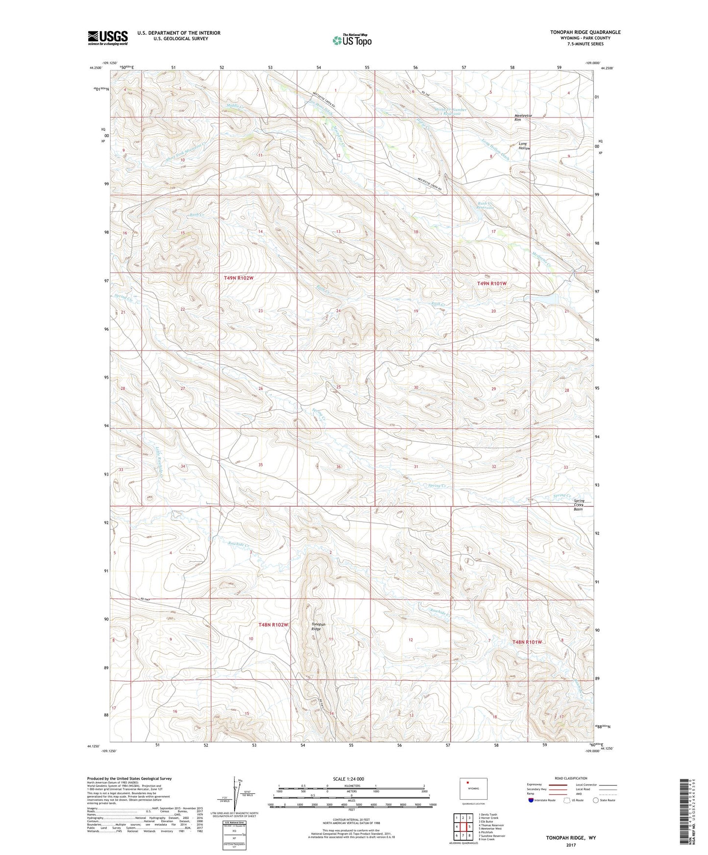
2021 topographic map quadrangle Tonopah Ridge in the state of Wyoming. Scale: 1:24000. Based on the newly updated USGS 7.5' US Topo map series, this map is in the following counties: Park. The map contains contour data, water features, and other items you are used to seeing on USGS maps, but also has updated roads and other features. This is the next generation of topographic maps. Printed on high-quality waterproof paper with UV fade-resistant inks.
Quads adjacent to this one:
West: Thomas Reservoir
Northwest: Devils Tooth
North: Horner Creek
Northeast: Elk Butte
East: Meeteetse West
Southeast: Iron Creek
South: Sunshine Reservoir
Southwest: Pitchfork
This map covers the same area as the classic USGS quad with code o44109b1.
Contains the following named places: Horse Creek, Horse Creek Number 1 Dam, Horse Creek Number 1 Reservoir, Joe Moss Ditch, Little Rawhide Creek, Long Hollow Ditch, Meeteetse Division, Meeteetse Rim, Middle Creek, Pitchfork Oil Field, Rush Creek, Rush Creek Dam, Rush Creek Reservoir, Short Fork Meeteetse Creek, Spring Creek Oil Field, Tonopah Ridge, Winninger Ranch