MyTopo
Survey Peak Wyoming US Topo Map
Couldn't load pickup availability
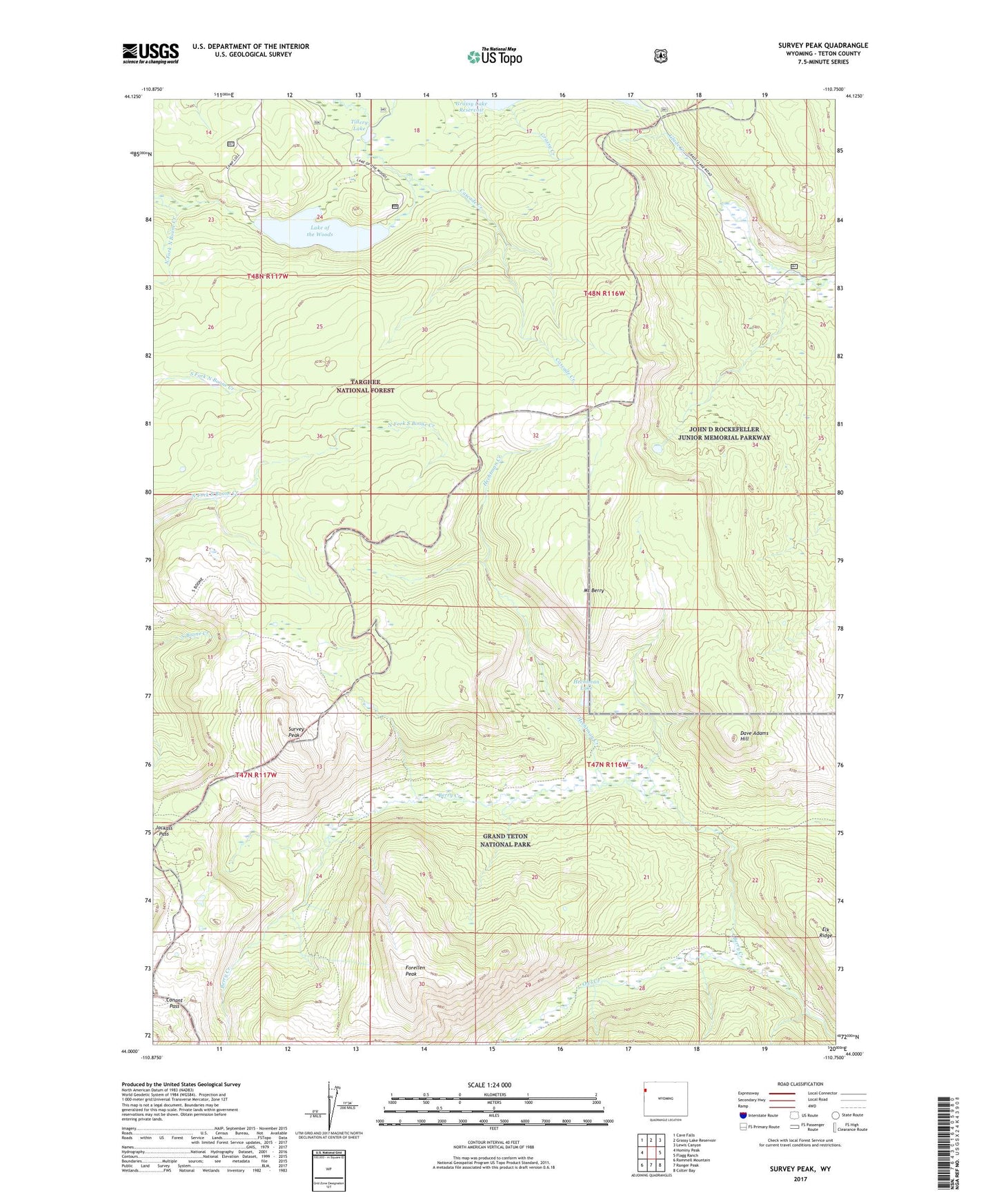
2021 topographic map quadrangle Survey Peak in the state of Wyoming. Scale: 1:24000. Based on the newly updated USGS 7.5' US Topo map series, this map is in the following counties: Teton. The map contains contour data, water features, and other items you are used to seeing on USGS maps, but also has updated roads and other features. This is the next generation of topographic maps. Printed on high-quality waterproof paper with UV fade-resistant inks.
Quads adjacent to this one:
West: Hominy Peak
Northwest: Cave Falls
North: Grassy Lake Reservoir
Northeast: Lewis Canyon
East: Flagg Ranch
Southeast: Colter Bay
South: Ranger Peak
Southwest: Rammell Mountain
Contains the following named places: Brown Bear Deposit, Conant Pass, Dave Adams Hill, Elk Ridge, Forellen Peak, Grassy Creek, Hechtman Creek, Hechtman Lake, Jackass Pass, Lake of the Woods, Mount Berry, Owl Creek, Survey Peak, Tillery Lake