MyTopo
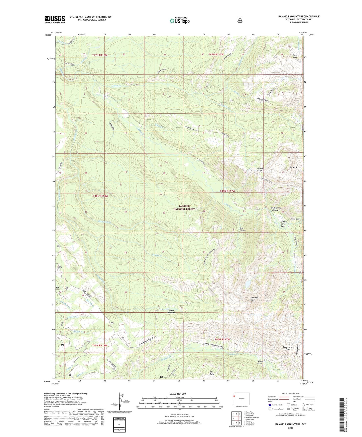
Rammell Mountain Wyoming US Topo Map
Couldn't load pickup availability
Also explore the Rammell Mountain Forest Service Topo of this same quad for updated USFS data
2021 topographic map quadrangle Rammell Mountain in the state of Wyoming. Scale: 1:24000. Based on the newly updated USGS 7.5' US Topo map series, this map is in the following counties: Teton. The map contains contour data, water features, and other items you are used to seeing on USGS maps, but also has updated roads and other features. This is the next generation of topographic maps. Printed on high-quality waterproof paper with UV fade-resistant inks.
Quads adjacent to this one:
West: McRenolds Reservoir
Northwest: Sheep Falls
North: Hominy Peak
Northeast: Survey Peak
East: Ranger Peak
Southeast: Mount Moran
South: Granite Basin
Southwest: Clawson
This map covers the same area as the classic USGS quad with code o43110h8.
Contains the following named places: Badger Creek Trail, Bear Canyon, Bear Canyon Trail, Bitch Creek Narrows, Bitch Creek Trail, Burnt Fork Creek, Carrot Ridge, Chicken Creek, Crater Creek, Dead Horse Pass, Grizzly Creek, Hidden Corral Basin, Indian Meadows, Mount Nord, North Bitch Creek, North Bitch Creek Trail, Poacher Trail, Rammell Mountain, Red Creek, Silver Creek, South Bitch Creek, Willow Flats, Youngs Point