MyTopo
The Horn Wyoming US Topo Map
Couldn't load pickup availability
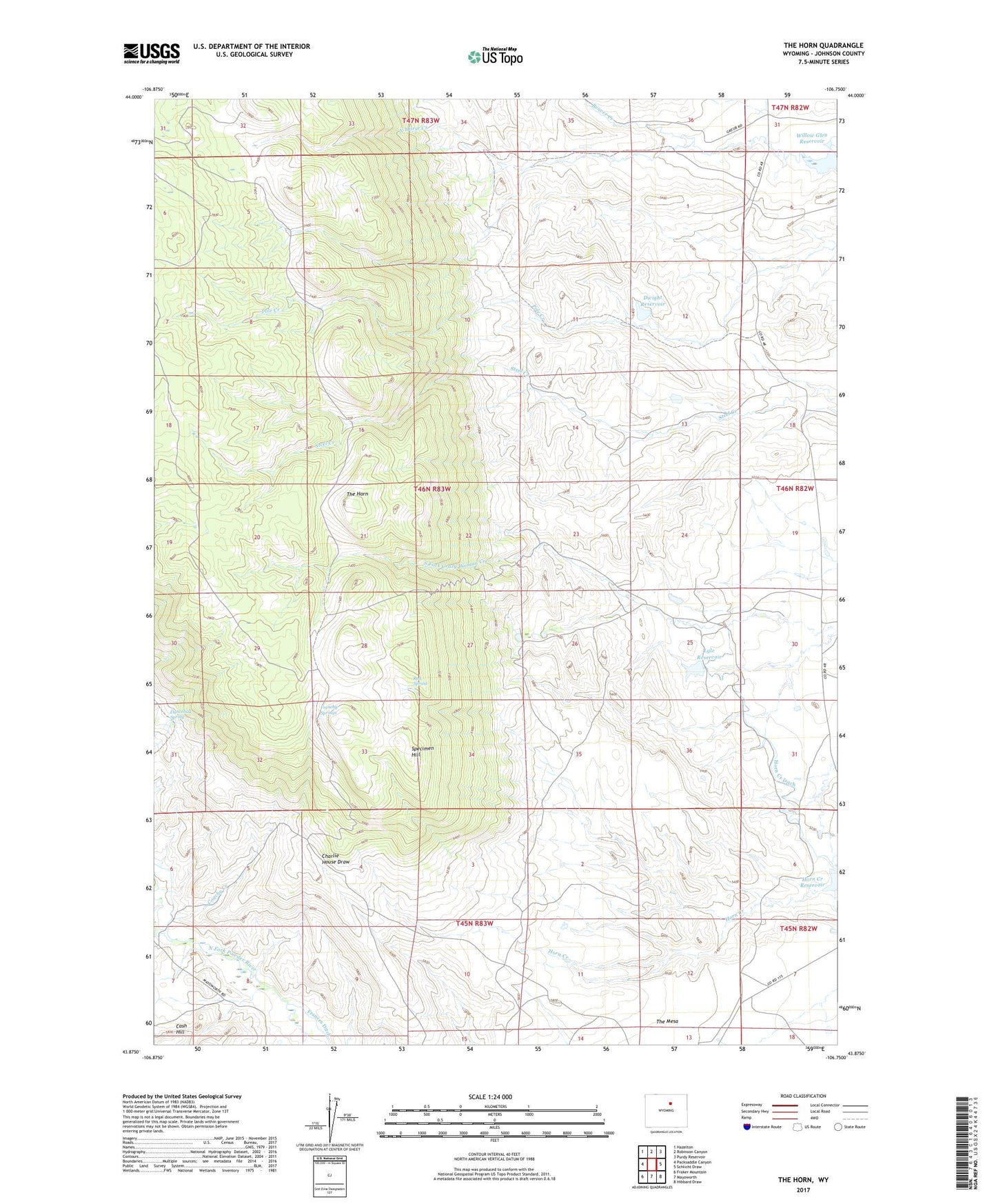
2021 topographic map quadrangle The Horn in the state of Wyoming. Scale: 1:24000. Based on the newly updated USGS 7.5' US Topo map series, this map is in the following counties: Johnson. The map contains contour data, water features, and other items you are used to seeing on USGS maps, but also has updated roads and other features. This is the next generation of topographic maps. Printed on high-quality waterproof paper with UV fade-resistant inks.
Quads adjacent to this one:
West: Packsaddle Canyon
Northwest: Hazelton
North: Robinson Canyon
Northeast: Purdy Reservoir
East: Schlicht Draw
Southeast: Hibbard Draw
South: Mayoworth
Southwest: Fraker Mountain
Contains the following named places: Adrian Ranch, Burdick Ranch, Canon Ditch, Cerlew Ditch, Close Call Ditch, Coachy Creek, Dancehall Spring, Dwight Dam, Dwight Reservoir, Dwite Dam, Frances Ditch, Frenchy Springs, Harris and Spang Ditch, Hesse Ditch, Horn Creek Ditch, Horn Creek Reservoir, Horse Creek, Lyle Dam, Lyle Reservoir, Noland Cabin, North Horse Creek, Osborn Ranch, Rambler Ditch, Ramsbottom Cowcamp, Ramsbottom Ranch, Red Spring, Simmons Ditch, Simmons Homestead, South Fork Crazy Woman Mine, Specimen Hill, The Horn, Willow Glen Ranch, Willow Glen Reservoir, Winingar Cabin