MyTopo
The Reefs Wyoming US Topo Map
Couldn't load pickup availability
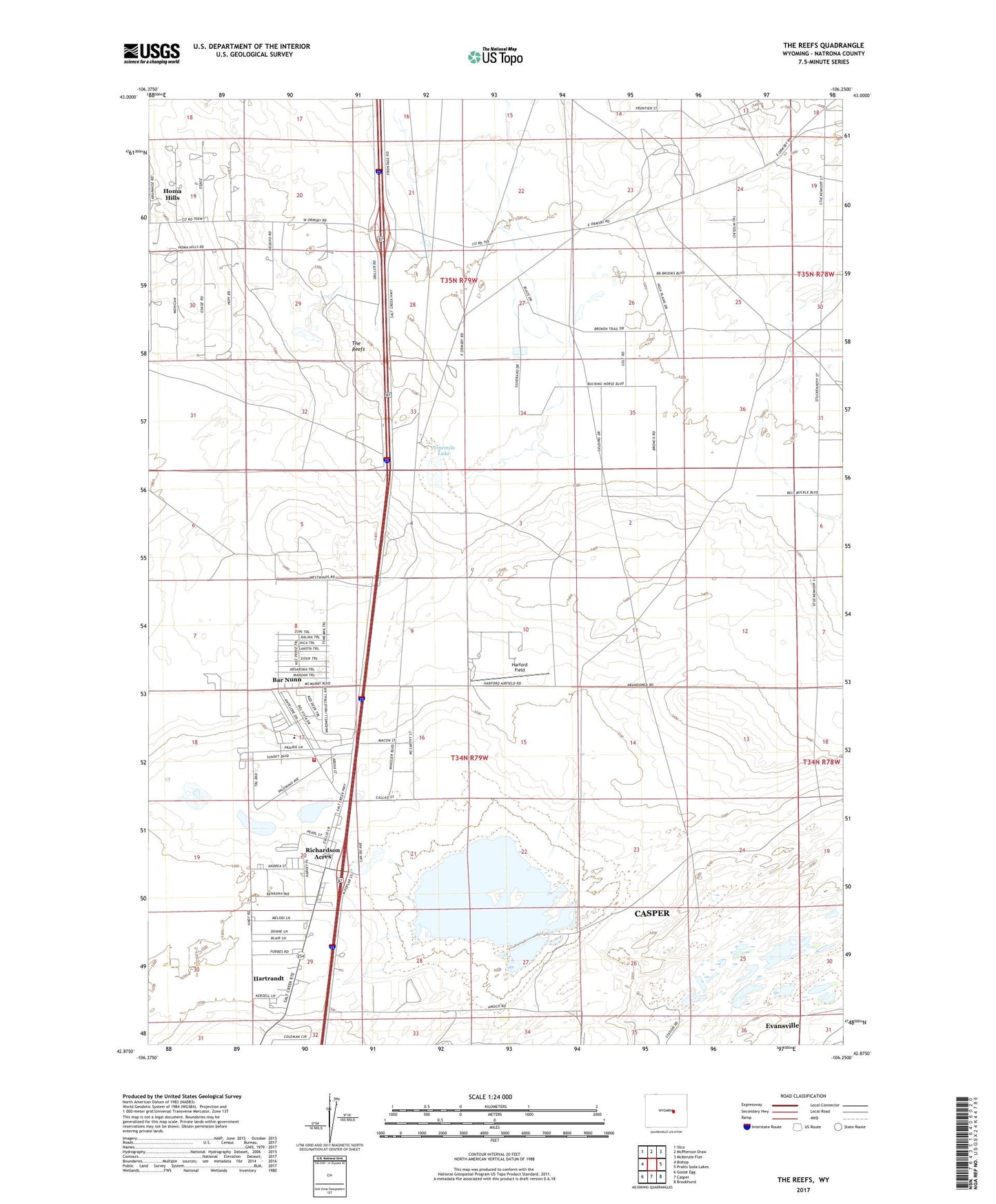
2021 topographic map quadrangle The Reefs in the state of Wyoming. Scale: 1:24000. Based on the newly updated USGS 7.5' US Topo map series, this map is in the following counties: Natrona. The map contains contour data, water features, and other items you are used to seeing on USGS maps, but also has updated roads and other features. This is the next generation of topographic maps. Printed on high-quality waterproof paper with UV fade-resistant inks.
Quads adjacent to this one:
West: Bishop
Northwest: Illco
North: McPherson Draw
Northeast: McKenzie Flat
East: Pratts Soda Lakes
Southeast: Brookhurst
South: Casper
Southwest: Goose Egg
This map covers the same area as the classic USGS quad with code o42106h3.
Contains the following named places: Bar Nunn, Bar Nunn Volunteer Fire Department, Dry Lake Mine, Harford Field, Hartrandt, Hartrandt Census Designated Place, Homa Hills, Homa Hills Census Designated Place, Meyers Mine, Midway Oil Field, Ninemile Lake, Nine-mile Lake Mine, Richardson Acres, Soda Lake, Soda Lake Dam, Sun Ray Pit, The Reefs, Town of Bar Nunn