MyTopo
Thornton Wyoming US Topo Map
Couldn't load pickup availability
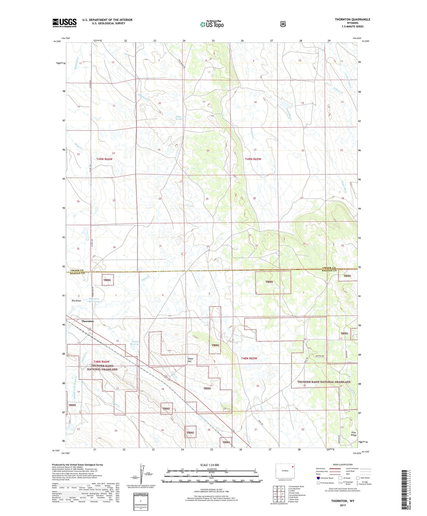
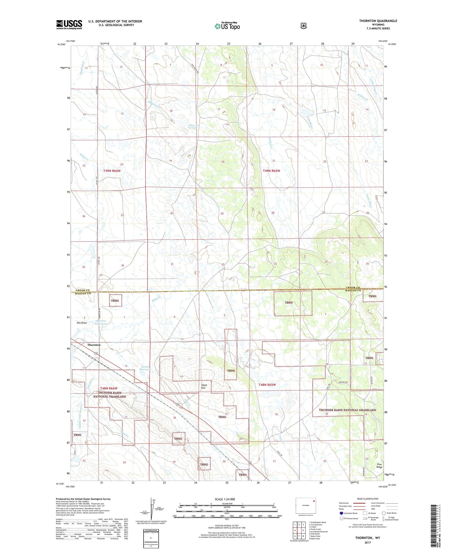
2021 topographic map quadrangle Thornton in the state of Wyoming. Scale: 1:24000. Based on the newly updated USGS 7.5' US Topo map series, this map is in the following counties: Crook, Weston. The map contains contour data, water features, and other items you are used to seeing on USGS maps, but also has updated roads and other features. This is the next generation of topographic maps. Printed on high-quality waterproof paper with UV fade-resistant inks.
Quads adjacent to this one:
West: Freda Creek
Northwest: Grasshopper Butte
North: Iron Mountain
Northeast: Linden
East: Arrowhead Reservoir
Southeast: Upton East
South: Upton West
Southwest: Soda Butte
Contains the following named places: Barton Ranch, Dry Draw, Green River, J W and M J Luman Dam, Luman Reservoir, Merich Ranch, Middle Fork Wind Creek, Patrick Creek, Shale Hill, Thornton, Thornton Reservoir, Upton Number Two