MyTopo
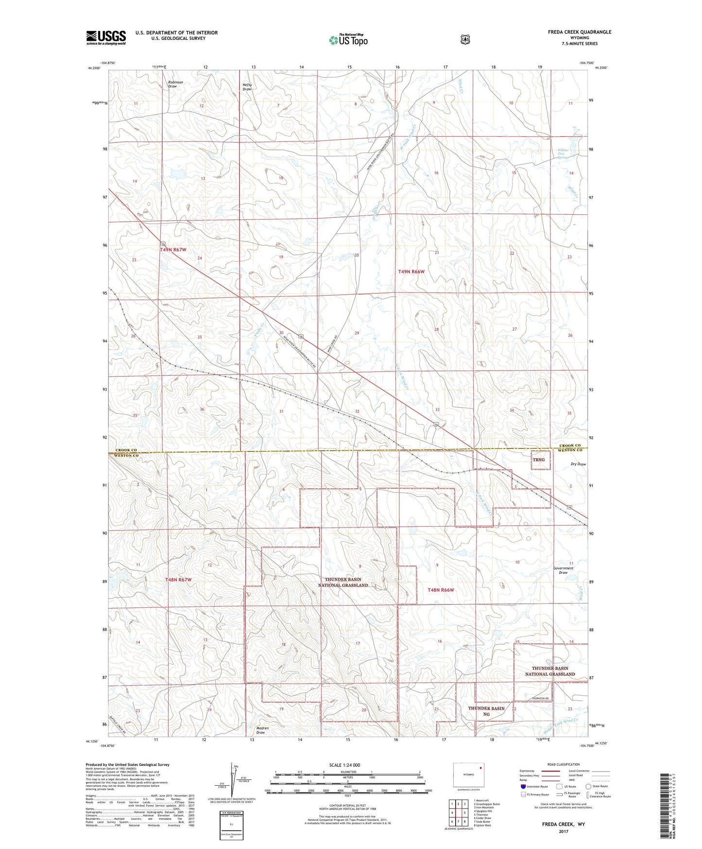
Freda Creek Wyoming US Topo Map
Couldn't load pickup availability
Also explore the Freda Creek Forest Service Topo of this same quad for updated USFS data
2021 topographic map quadrangle Freda Creek in the state of Wyoming. Scale: 1:24000. Based on the newly updated USGS 7.5' US Topo map series, this map is in the following counties: Crook, Weston. The map contains contour data, water features, and other items you are used to seeing on USGS maps, but also has updated roads and other features. This is the next generation of topographic maps. Printed on high-quality waterproof paper with UV fade-resistant inks.
Quads adjacent to this one:
West: Spyglass Hill
Northwest: Moorcroft
North: Grasshopper Butte
Northeast: Iron Mountain
East: Thornton
Southeast: Upton West
South: Soda Butte
Southwest: Cedar Draw
This map covers the same area as the classic USGS quad with code o44104b7.
Contains the following named places: Barton Dam, Barton Reservoir, Clyde Ranch, Dumbrill Creek, E E Wakeman Dam, E E Wakeman Reservoir, Freda Creek, Government Draw, Kara, Mirich Dam, Mirich Reservoir, Syndicate Dam, Syndicate Reservoir, Thomas Number 1 Dam, Thomas Number 1 Reservoir, Willow Tree Springs