MyTopo
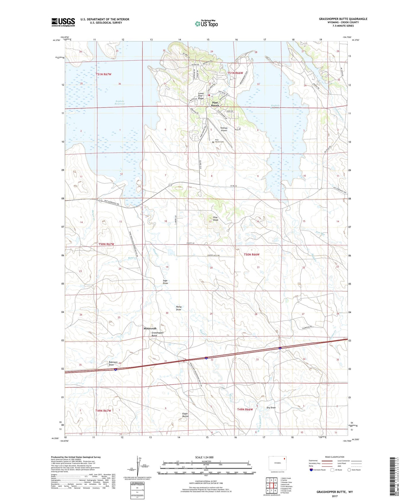
Grasshopper Butte Wyoming US Topo Map
Couldn't load pickup availability
2021 topographic map quadrangle Grasshopper Butte in the state of Wyoming. Scale: 1:24000. Based on the newly updated USGS 7.5' US Topo map series, this map is in the following counties: Crook. The map contains contour data, water features, and other items you are used to seeing on USGS maps, but also has updated roads and other features. This is the next generation of topographic maps. Printed on high-quality waterproof paper with UV fade-resistant inks.
Quads adjacent to this one:
West: Moorcroft
Northwest: Edith Creek
North: Carlile
Northeast: Wonder View
East: Iron Mountain
Southeast: Thornton
South: Freda Creek
Southwest: Spyglass Hill
This map covers the same area as the classic USGS quad with code o44104c7.
Contains the following named places: Berger Creek, Berger Dam, Berger Reservoir, Bond Creek, Bute Dam, Bute Reservoir, Cottonwood Creek, Deer Creek, Dry Draw, Eagle Buttes, Grasshopper Butte, Iron Run, Joanne Creek, Keyhole Airport, Keyhole Reservoir, Lone Tree Creek, Lower Pine Ridge, Mary and Stella Mulholland Dam, Mary and Stella Mulholland Reservoir, Mule Creek, Nefsy Draw, Pine Haven, Pine Haven Cemetery, Pine Haven Volunteer Fire Department, Pine Knob, Robinson Draw, Sage Draw, Thompson Ranch, Town of Pine Haven, West Fork Wind Creek, Wind Creek