MyTopo
Rongis Reservoir Wyoming US Topo Map
Couldn't load pickup availability
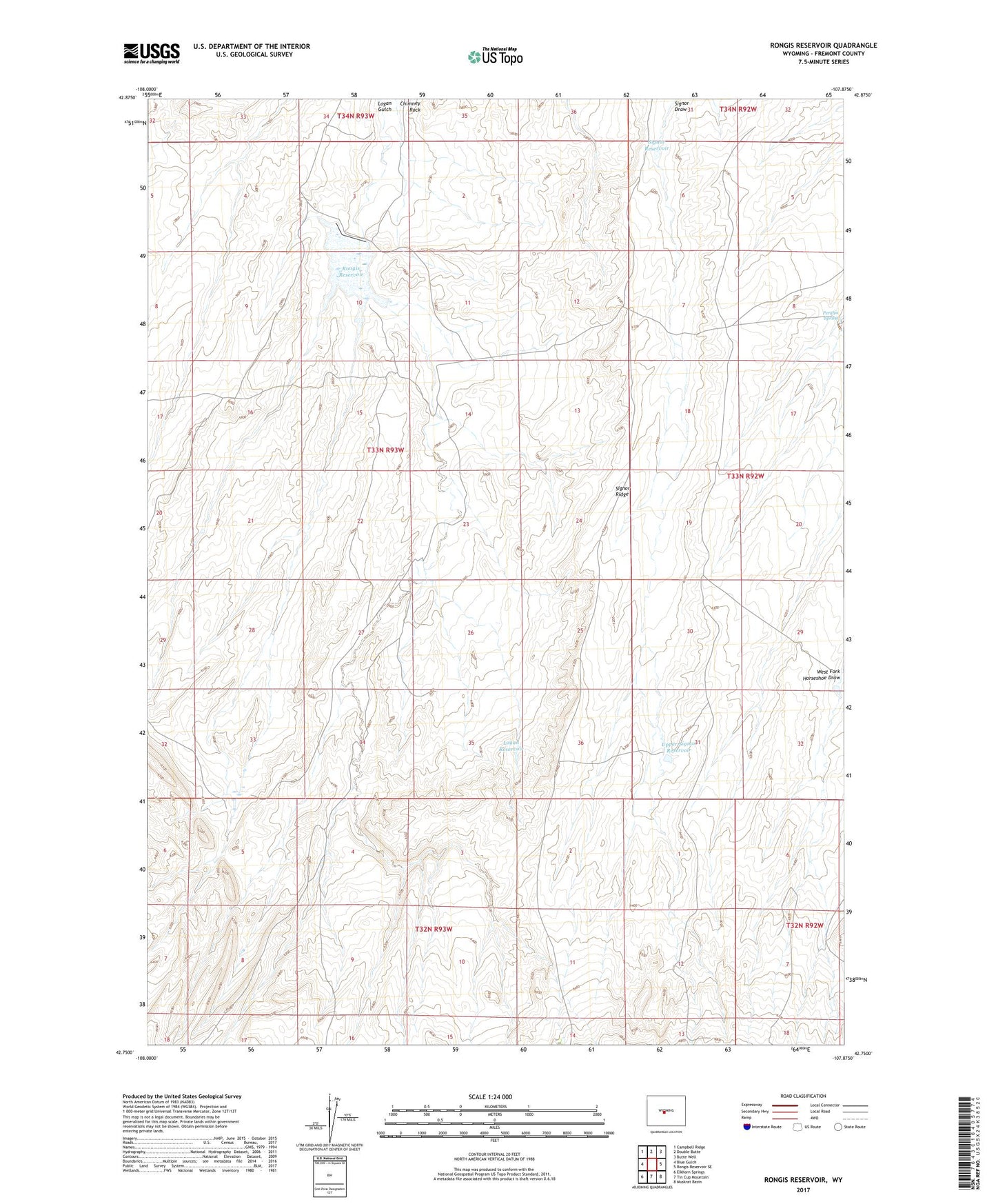
2021 topographic map quadrangle Rongis Reservoir in the state of Wyoming. Scale: 1:24000. Based on the newly updated USGS 7.5' US Topo map series, this map is in the following counties: Fremont. The map contains contour data, water features, and other items you are used to seeing on USGS maps, but also has updated roads and other features. This is the next generation of topographic maps. Printed on high-quality waterproof paper with UV fade-resistant inks.
Quads adjacent to this one:
West: Blue Gulch
Northwest: Campbell Ridge
North: Double Butte
Northeast: Butte Well
East: Rongis Reservoir SE
Southeast: Muskrat Basin
South: Tin Cup Mountain
Southwest: Elkhorn Springs
This map covers the same area as the classic USGS quad with code o42107g8.
Contains the following named places: Chimney Rock, Donna Lee Mine, Grives Ranch, Logan Gulch Oil Well Number 1, Logan Gulch Oil Well Number 2, Logan Reservoir, Myers Ranch, Peralta Spring, Rongis Detention Dam, Rongis Reservoir, Signor Reservoir, Signor Ridge, Upper Signor Reservoir