MyTopo
Blue Gulch Wyoming US Topo Map
Couldn't load pickup availability
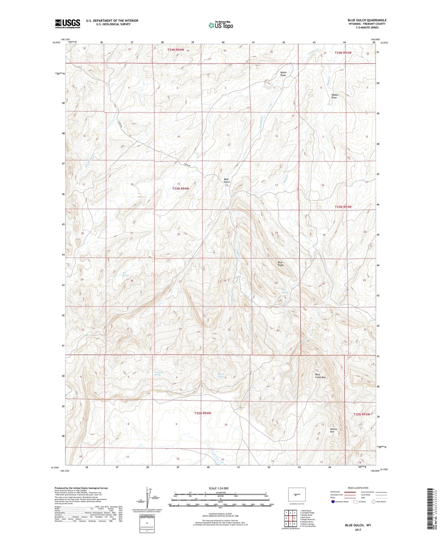
2021 topographic map quadrangle Blue Gulch in the state of Wyoming. Scale: 1:24000. Based on the newly updated USGS 7.5' US Topo map series, this map is in the following counties: Fremont. The map contains contour data, water features, and other items you are used to seeing on USGS maps, but also has updated roads and other features. This is the next generation of topographic maps. Printed on high-quality waterproof paper with UV fade-resistant inks.
Quads adjacent to this one:
West: Sand Draw
Northwest: Alkali Butte
North: Campbell Ridge
Northeast: Double Butte
East: Rongis Reservoir
Southeast: Tin Cup Mountain
South: Elkhorn Springs
Southwest: Dishpan Butte
This map covers the same area as the classic USGS quad with code o42108g1.
Contains the following named places: Alkali Butte Mine, Blue Gulch, Blue Ridge, Boiler Draw, Cocharn Mine, Cogswell Spring, Connant Creek Mine, Coohow Number One Mine, Groveland Number One Mine, Keg Spring, Moone Creek, Moone Spring, Nose Number One and Butch Number Two Mine, Oil Mountain Number One Mine, Pipe Spring, Rock Creek Mountain, Strubel Number Fourteen-A Mine, Walker Draw