MyTopo
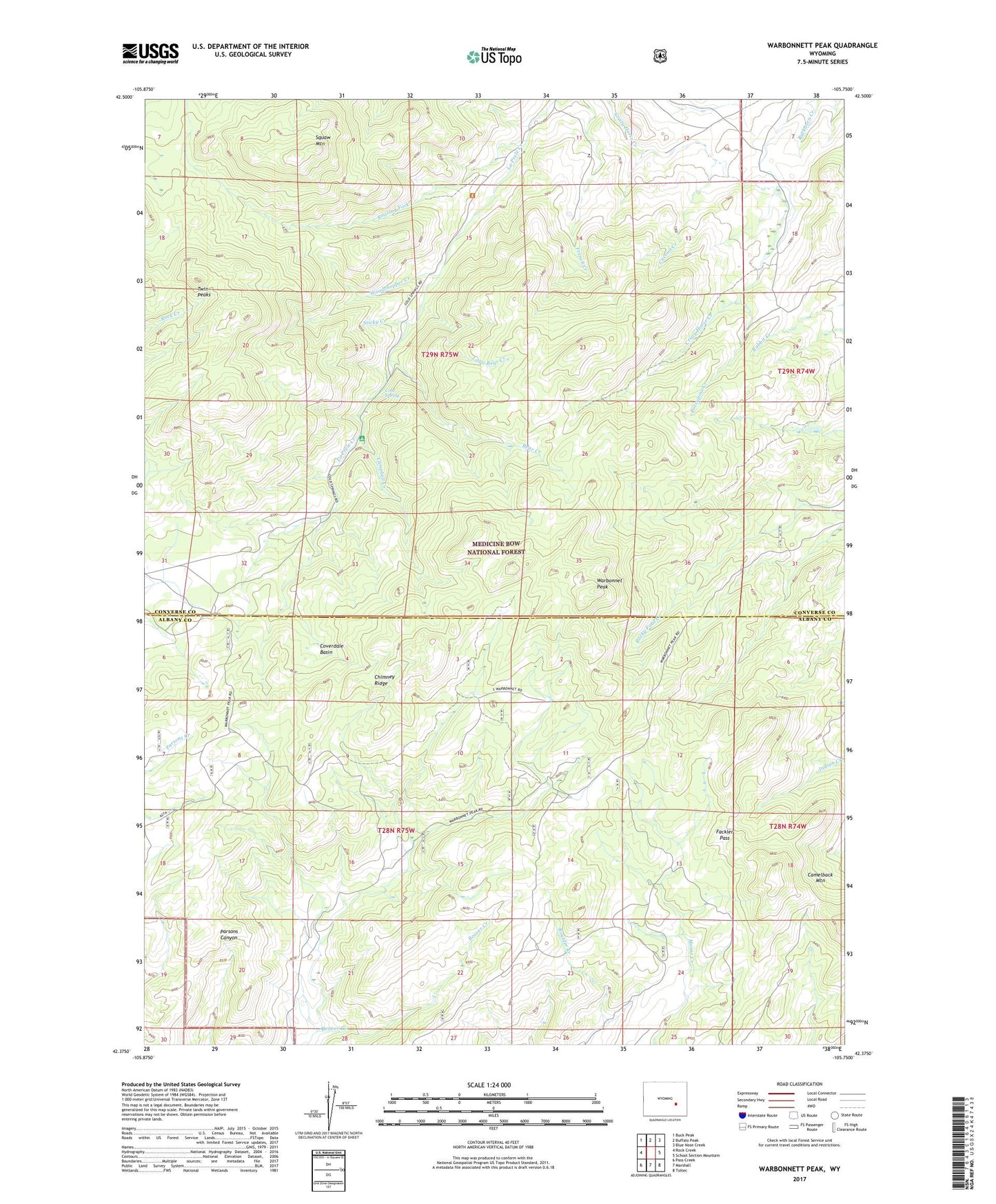
Warbonnett Peak Wyoming US Topo Map
Couldn't load pickup availability
Also explore the Warbonnett Peak Forest Service Topo of this same quad for updated USFS data
2023 topographic map quadrangle Warbonnett Peak in the state of Wyoming. Scale: 1:24000. Based on the newly updated USGS 7.5' US Topo map series, this map is in the following counties: Converse, Albany. The map contains contour data, water features, and other items you are used to seeing on USGS maps, but also has updated roads and other features. This is the next generation of topographic maps. Printed on high-quality waterproof paper with UV fade-resistant inks.
Quads adjacent to this one:
West: Rock Creek
Northwest: Buck Peak
North: Buffalo Peak
Northeast: Blue Nose Creek
East: School Section Mountain
Southeast: Toltec
South: Marshall
Southwest: Pass Creek
This map covers the same area as the classic USGS quad with code o42105d7.
Contains the following named places: Bear Creek, Beaver Creek, Cacona Creek, Camelback Mountain, Campbell Creek, Campbell Creek Campground, Chimney Ridge, Cold Spring, Coverdale Basin, Fackler Pass, H-V Ranch, LaPrele Ranger Station, Little Bear Creek, Old Copper King Mine, Oriole Mine, Porcupine Creek, Roaring Fork, Squaw Mountain, Sticky Creek, Twin Peaks, Warbonnet Peak, Woodchopper Creek