MyTopo
Triple Peak Wyoming US Topo Map
Couldn't load pickup availability
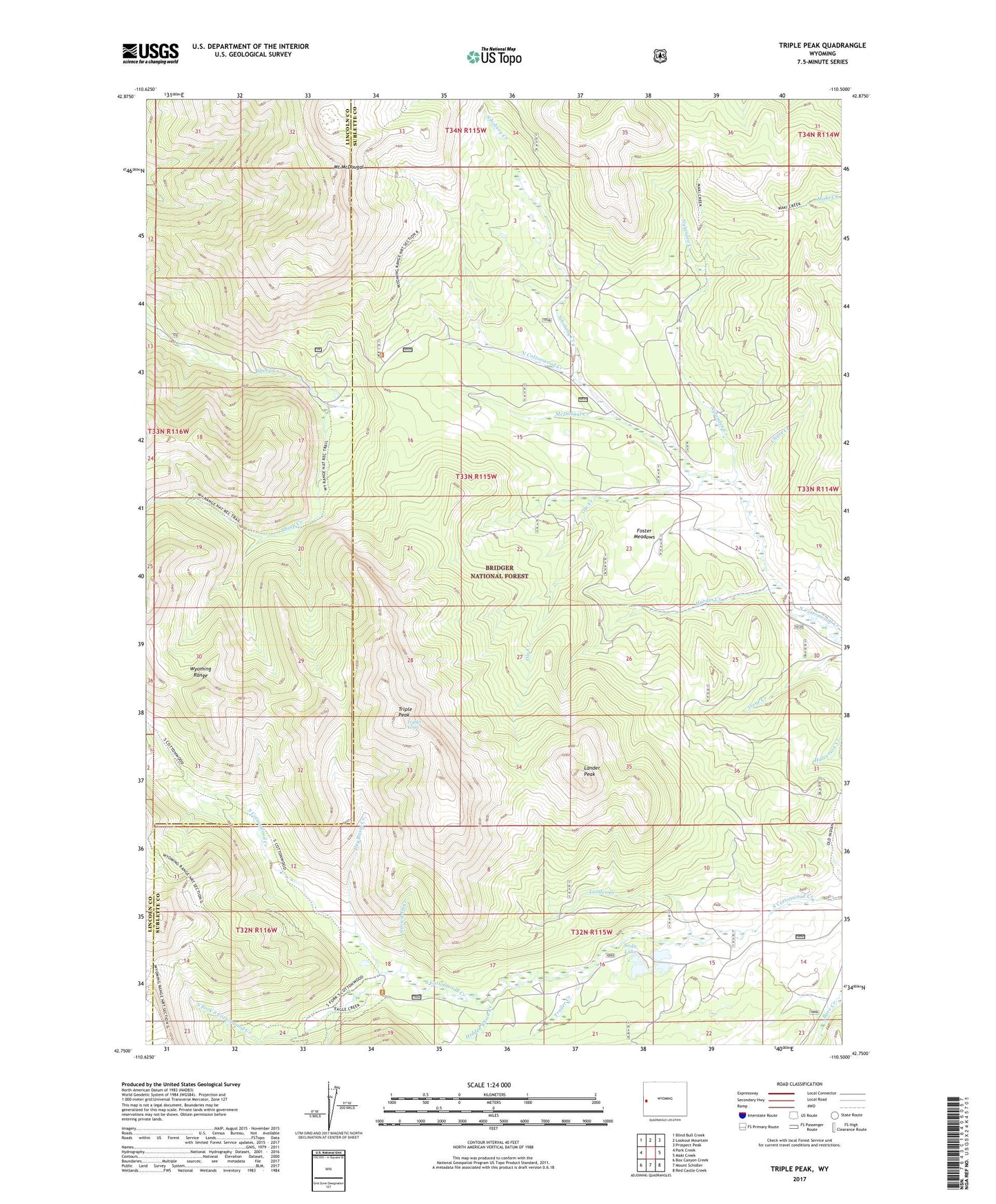
2021 topographic map quadrangle Triple Peak in the state of Wyoming. Scale: 1:24000. Based on the newly updated USGS 7.5' US Topo map series, this map is in the following counties: Sublette, Lincoln. The map contains contour data, water features, and other items you are used to seeing on USGS maps, but also has updated roads and other features. This is the next generation of topographic maps. Printed on high-quality waterproof paper with UV fade-resistant inks.
Quads adjacent to this one:
West: Park Creek
Northwest: Blind Bull Creek
North: Lookout Mountain
Northeast: Prospect Peak
East: Maki Creek
Southeast: Red Castle Creek
South: Mount Schidler
Southwest: Box Canyon Creek
Contains the following named places: Chase Creek, Cottonwood Mine, Dry Basin Creek, Eagle Creek, Foster Meadows, Hardin Creek, Hidden Basin Creek, Kleinstick Mine, Lander Creek, Lander Peak, McDougal Creek, Mount McDougal, New Cottonwood Mine, Nylander Creek, Ole Creek, Sheep Creek Divide Mine, Sjhoberg Creek, Smith Mine, Snowdrift Creek, Soda Lake, South Fork South Cottonwood Creek, Tie-Hack Cabins, Trailer Creek, Triple Peak, Triplet Vents