MyTopo
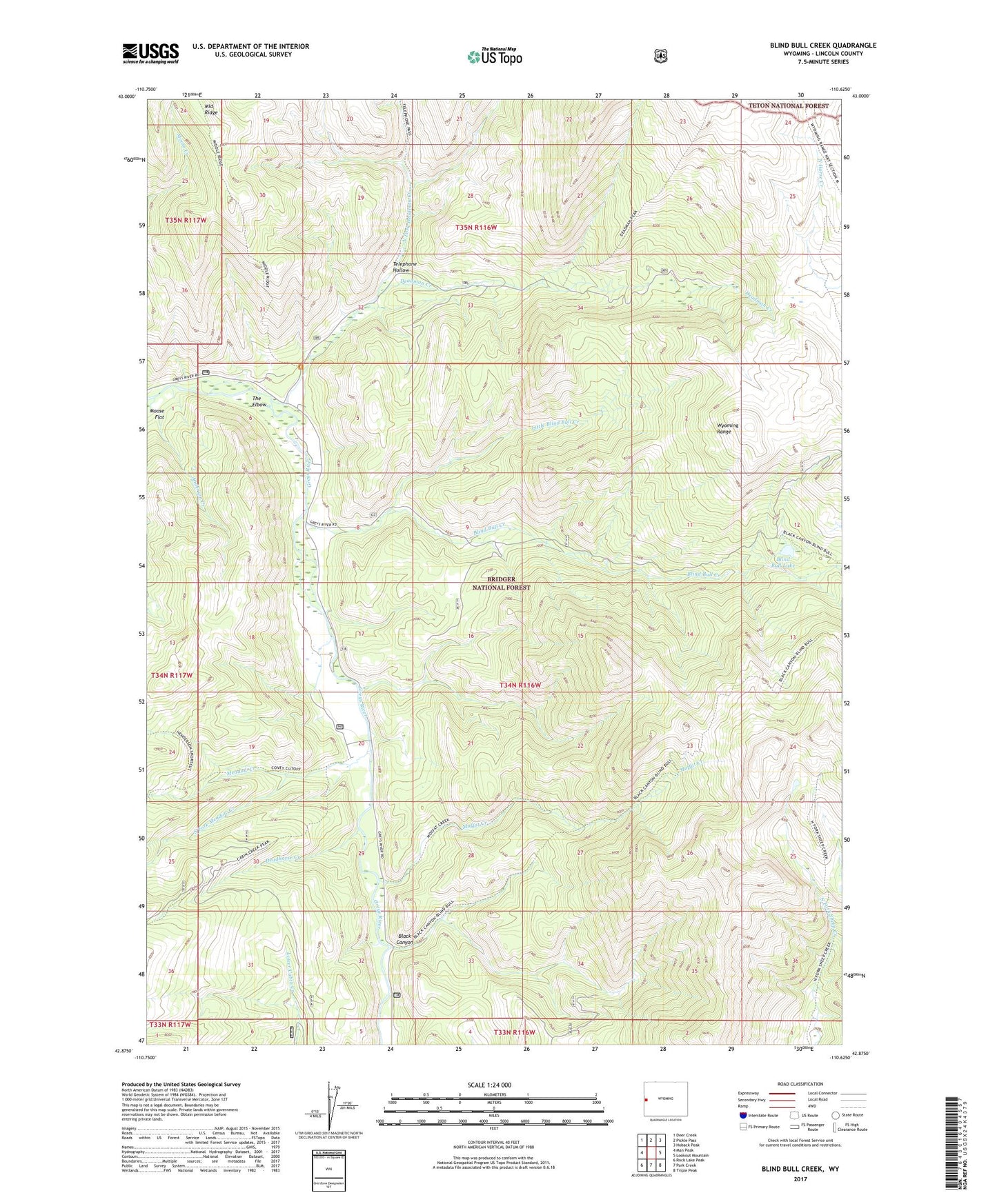
Blind Bull Creek Wyoming US Topo Map
Couldn't load pickup availability
Also explore the Blind Bull Creek Forest Service Topo of this same quad for updated USFS data
2021 topographic map quadrangle Blind Bull Creek in the state of Wyoming. Scale: 1:24000. Based on the newly updated USGS 7.5' US Topo map series, this map is in the following counties: Lincoln. The map contains contour data, water features, and other items you are used to seeing on USGS maps, but also has updated roads and other features. This is the next generation of topographic maps. Printed on high-quality waterproof paper with UV fade-resistant inks.
Quads adjacent to this one:
West: Man Peak
Northwest: Deer Creek
North: Pickle Pass
Northeast: Hoback Peak
East: Lookout Mountain
Southeast: Triple Peak
South: Park Creek
Southwest: Rock Lake Peak
This map covers the same area as the classic USGS quad with code o42110h6.
Contains the following named places: Alpine Mine, Anderson Creek, Black Canyon, Blind Bull Creek, Blind Bull Lake, Blind Bull Mine, Box Y Ranch, Deadhorse Creek, Deadman Creek, Deadman Gulch Mine, Henderson Creek, Little Blind Bull Creek, Meadow Creek, Meadow Creek Guard Station, Meadows Forest Service Facility, Moffat Creek, North Fork Deadman Creek, Old Blind Bull Mine, South Fork Meadow Creek, Telephone Hollow, The Elbow, Trail Creek, Vail Mine, West Mine