MyTopo
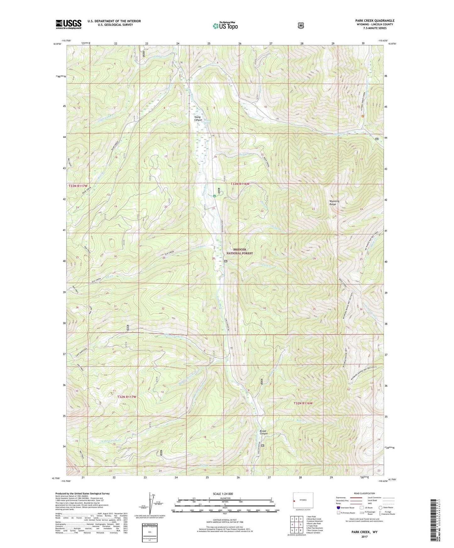
Park Creek Wyoming US Topo Map
Couldn't load pickup availability
Also explore the Park Creek Forest Service Topo of this same quad for updated USFS data
2021 topographic map quadrangle Park Creek in the state of Wyoming. Scale: 1:24000. Based on the newly updated USGS 7.5' US Topo map series, this map is in the following counties: Lincoln. The map contains contour data, water features, and other items you are used to seeing on USGS maps, but also has updated roads and other features. This is the next generation of topographic maps. Printed on high-quality waterproof paper with UV fade-resistant inks.
Quads adjacent to this one:
West: Rock Lake Peak
Northwest: Man Peak
North: Blind Bull Creek
Northeast: Lookout Mountain
East: Triple Peak
Southeast: Mount Schidler
South: Box Canyon Creek
Southwest: Red Top Mountain
This map covers the same area as the classic USGS quad with code o42110g6.
Contains the following named places: Bear Creek, Broad Canyon, Buck Creek, Bug Creek, Cabin Creek, Elk Creek, Forest Park Campground, Forest Park Elk Wintering Area, Lower Cabin Creek, Middle Three Forks Creek, North Fork Sheep Creek, North Three Forks Creek, North Twin Creek, Park Creek, Red Creek, Ridge Creek, Rock Creek, Sheep Creek, Sheep Creek Canyon Mine, South Three Forks Creek, South Twin Creek, Upper Cabin Creek, Wyoming Range Trail, Young Canyon, Young Spring