MyTopo
Twentyone Creek Wyoming US Topo Map
Couldn't load pickup availability
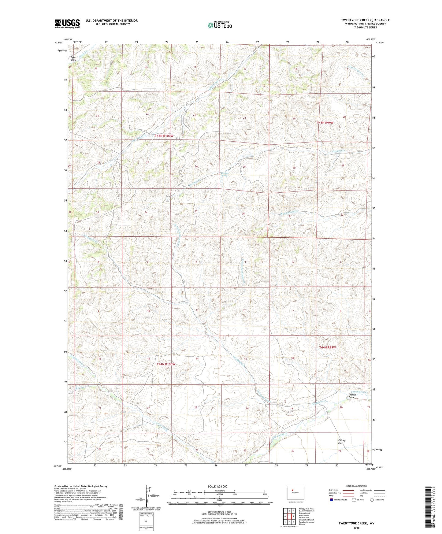
2021 topographic map quadrangle Twentyone Creek in the state of Wyoming. Scale: 1:24000. Based on the newly updated USGS 7.5' US Topo map series, this map is in the following counties: Hot Springs. The map contains contour data, water features, and other items you are used to seeing on USGS maps, but also has updated roads and other features. This is the next generation of topographic maps. Printed on high-quality waterproof paper with UV fade-resistant inks.
Quads adjacent to this one:
West: Milk Creek
Northwest: Soapy Dale Peak
North: Adam Weiss Peak
Northeast: Grass Creek
East: Crater Sink
Southeast: Embar
South: Anchor Reservoir
Southwest: Eagle Nest Ranch
This map covers the same area as the classic USGS quad with code o43108g7.
Contains the following named places: Dickie Ranch, Dugout Draw, East Fork Twentyone Creek, Lake Creek, Pershal Spring, Putney Flat, Rankin Cow Camp, Rhodes Ranch, Twentyone Creek, West Fork Twentyone Creek