MyTopo
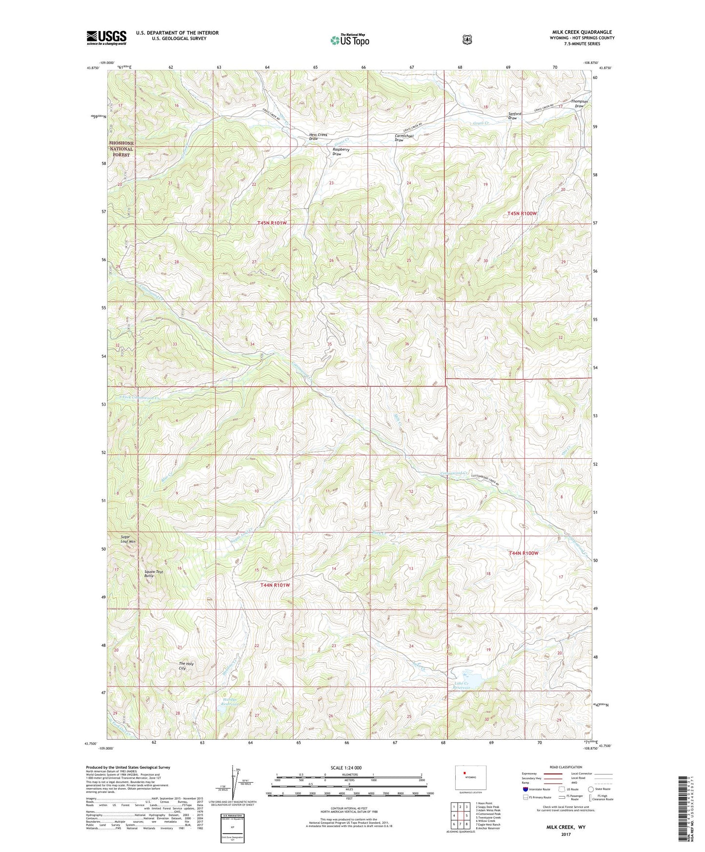
Milk Creek Wyoming US Topo Map
Couldn't load pickup availability
Also explore the Milk Creek Forest Service Topo of this same quad for updated USFS data
2023 topographic map quadrangle Milk Creek in the state of Wyoming. Scale: 1:24000. Based on the newly updated USGS 7.5' US Topo map series, this map is in the following counties: Hot Springs. The map contains contour data, water features, and other items you are used to seeing on USGS maps, but also has updated roads and other features. This is the next generation of topographic maps. Printed on high-quality waterproof paper with UV fade-resistant inks.
Quads adjacent to this one:
West: Cottonwood Peak
Northwest: Noon Point
North: Soapy Dale Peak
Northeast: Adam Weiss Peak
East: Twentyone Creek
Southeast: Anchor Reservoir
South: Eagle Nest Ranch
Southwest: Willow Creek
This map covers the same area as the classic USGS quad with code o43108g8.
Contains the following named places: Anderson Sawmill, Blue Creek, Buck Creek, Carmichael Draw, Dvarishkis Hunting Camp, Egbert Draw, Hardys Reservoir, Hess Creek Draw, L U Cow Camp, Lake Creek Dam, Lake Creek Reservoir, Milk Creek, Ota Creek, Otto Creek, Raspberry Draw, Roach Creek, Sanford Draw, South Fork Cottonwood Creek, Squaw Teat Butte, Sugar Loaf Creek, Sugar Loaf Mountain, T A Cow Camp, The Holy City, Thompson Draw