MyTopo
Ulm Wyoming US Topo Map
Couldn't load pickup availability
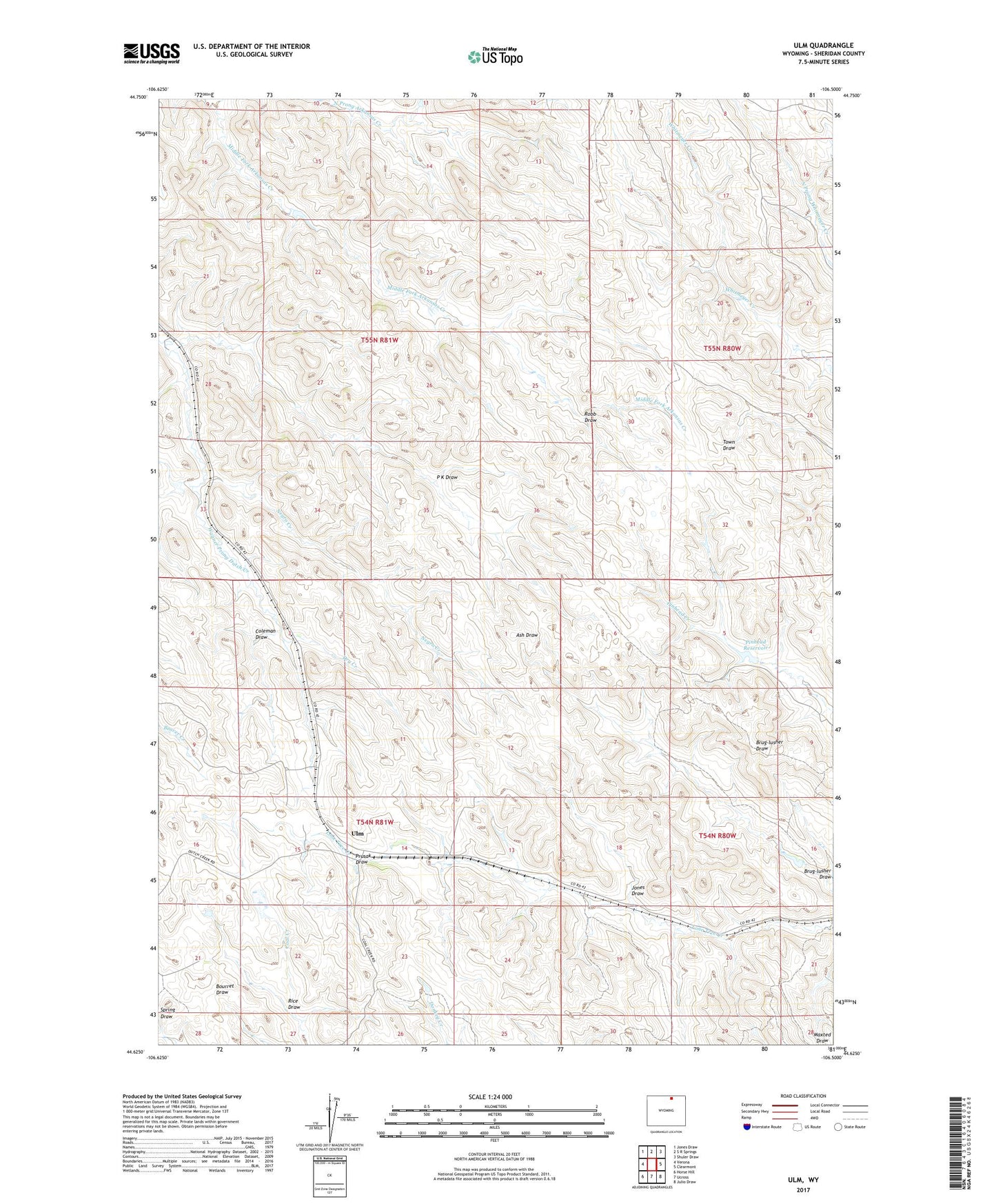
2021 topographic map quadrangle Ulm in the state of Wyoming. Scale: 1:24000. Based on the newly updated USGS 7.5' US Topo map series, this map is in the following counties: Sheridan. The map contains contour data, water features, and other items you are used to seeing on USGS maps, but also has updated roads and other features. This is the next generation of topographic maps. Printed on high-quality waterproof paper with UV fade-resistant inks.
Quads adjacent to this one:
West: Verona
Northwest: Jones Draw
North: S R Springs
Northeast: Shuler Draw
East: Clearmont
Southeast: Julio Draw
South: Ucross
Southwest: Horse Hill
Contains the following named places: Brug-lusher Draw, Coleman Draw, Dry Creek, Jones Draw, Middle Fork Arkansas Creek, Negro Creek, North Prong Arkansas Creek, P K Draw, Pinhead Dam, Pinhead Reservoir, Prusak Draw, Rice Draw, Robb Draw, Ulm