MyTopo
Upton East Wyoming US Topo Map
Couldn't load pickup availability
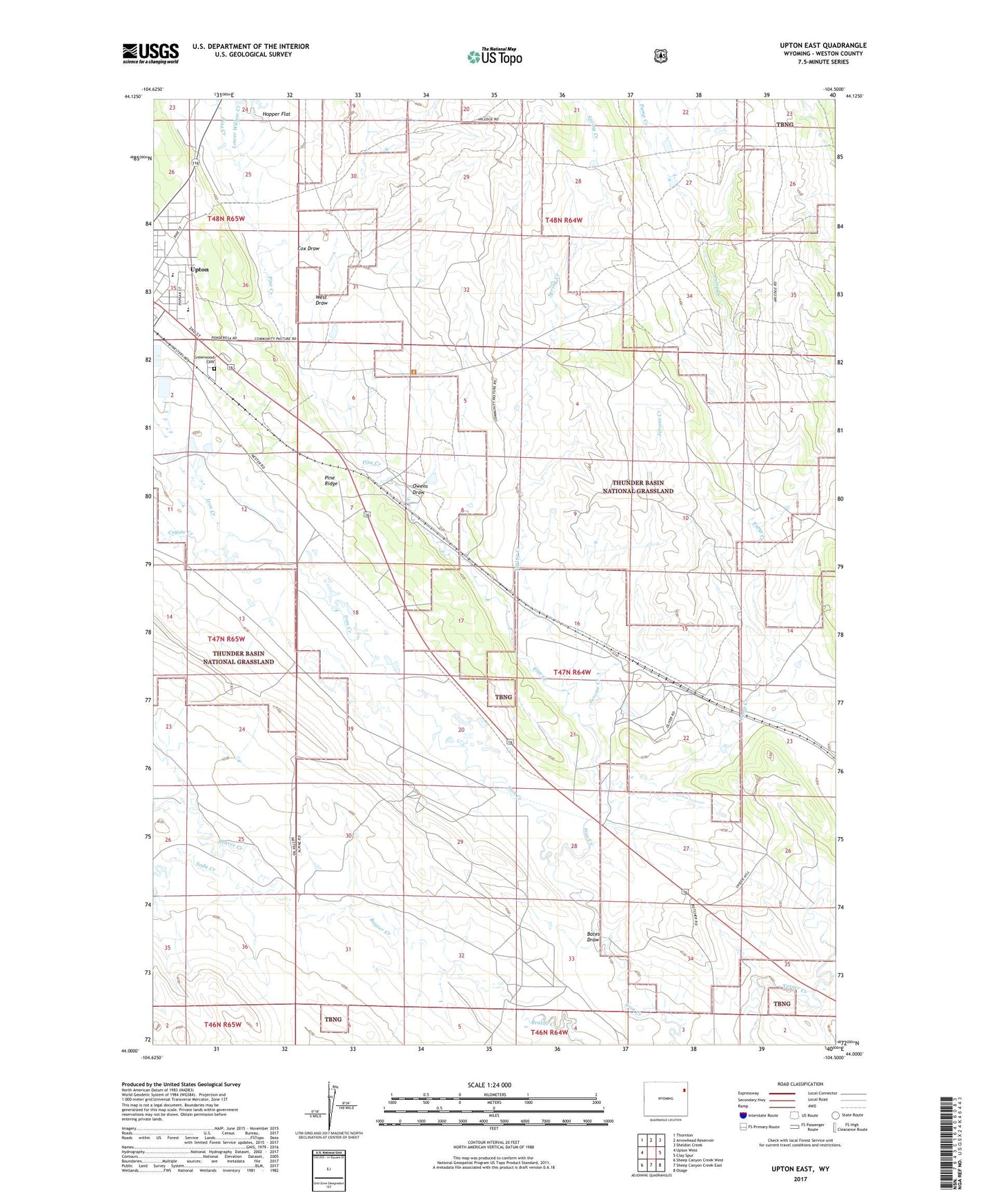
2021 topographic map quadrangle Upton East in the state of Wyoming. Scale: 1:24000. Based on the newly updated USGS 7.5' US Topo map series, this map is in the following counties: Weston. The map contains contour data, water features, and other items you are used to seeing on USGS maps, but also has updated roads and other features. This is the next generation of topographic maps. Printed on high-quality waterproof paper with UV fade-resistant inks.
Quads adjacent to this one:
West: Upton West
Northwest: Thornton
North: Arrowhead Reservoir
Northeast: Sheldon Creek
East: Clay Spur
Southeast: Osage
South: Sheep Canyon Creek East
Southwest: Sheep Canyon Creek West
Contains the following named places: Bates Draw, Beaver Creek Mine, Bowl Dam, Bowl Reservoir, Cox Draw, Coyote Creek, Greenwood Cemetery, Jerome, Jerome Area Mine, Jerome Creek, Lower Willow Creek, Oliver Ranch, Owens Draw, Owens Draw Mine, Pine Creek, Pine Ridge Mine, Pump Creek, Soda Creek, South Branch Beaver Creek, Spring Creek, Turner Creek Mine, Upton Number One, West Draw