MyTopo
Birdseye Pass Wyoming US Topo Map
Couldn't load pickup availability
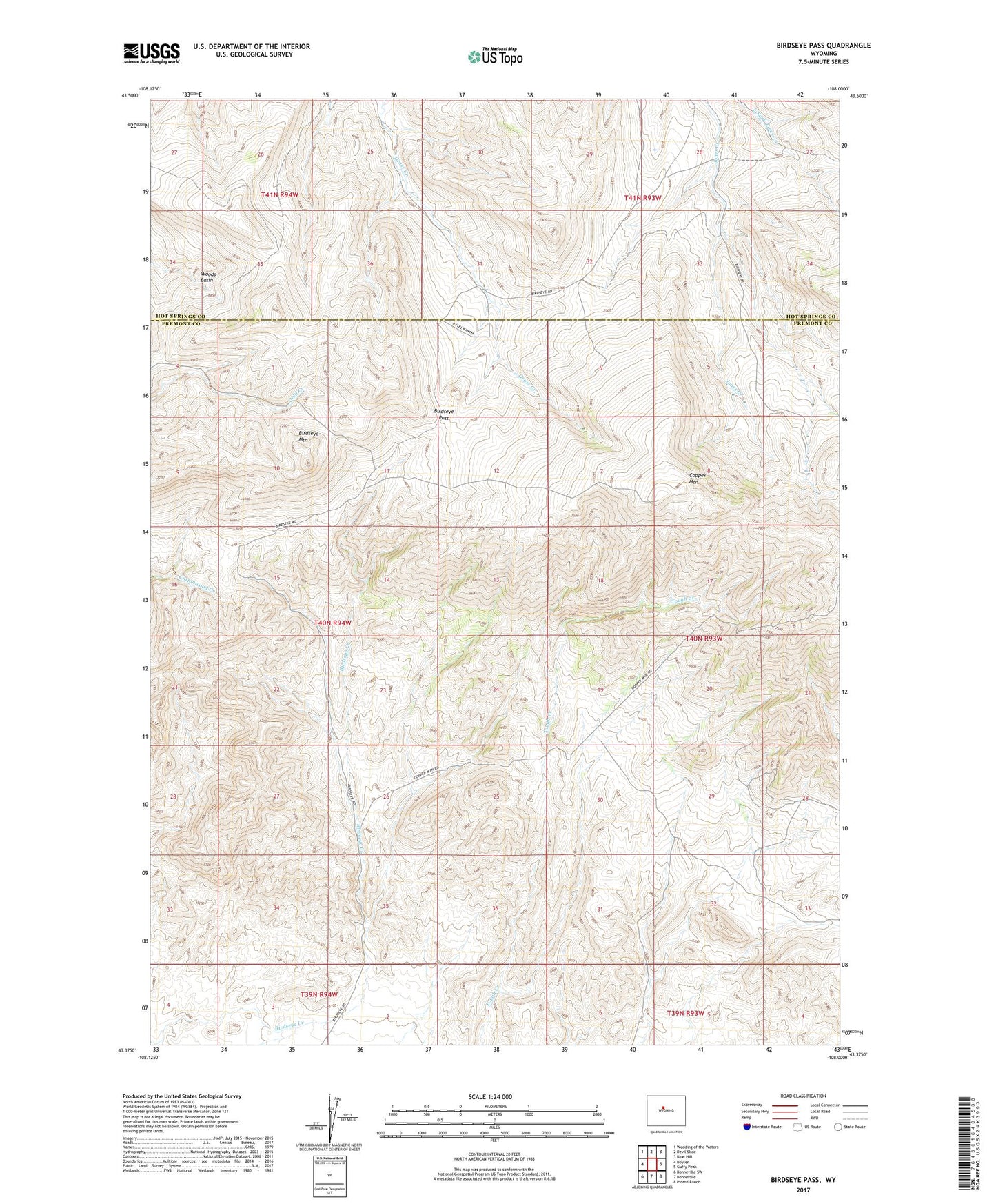
2021 topographic map quadrangle Birdseye Pass in the state of Wyoming. Scale: 1:24000. Based on the newly updated USGS 7.5' US Topo map series, this map is in the following counties: Fremont, Hot Springs. The map contains contour data, water features, and other items you are used to seeing on USGS maps, but also has updated roads and other features. This is the next generation of topographic maps. Printed on high-quality waterproof paper with UV fade-resistant inks.
Quads adjacent to this one:
West: Boysen
Northwest: Wedding of the Waters
North: Devil Slide
Northeast: Blue Hill
East: Guffy Peak
Southeast: Picard Ranch
South: Bonneville
Southwest: Bonneville SW
This map covers the same area as the classic USGS quad with code o43108d1.
Contains the following named places: Birdseye Mountain, Birdseye Pass, Birdseye Ranch, Birdseye Station, CDM Number One and Hardluck Number 1-B Mine, Gold Nugget Mine, Olive Five Claim, Romur Claims, Shooting Star Claim, Victory Claim, Whippet Number One Prospect Mine, Willie O Mine