MyTopo
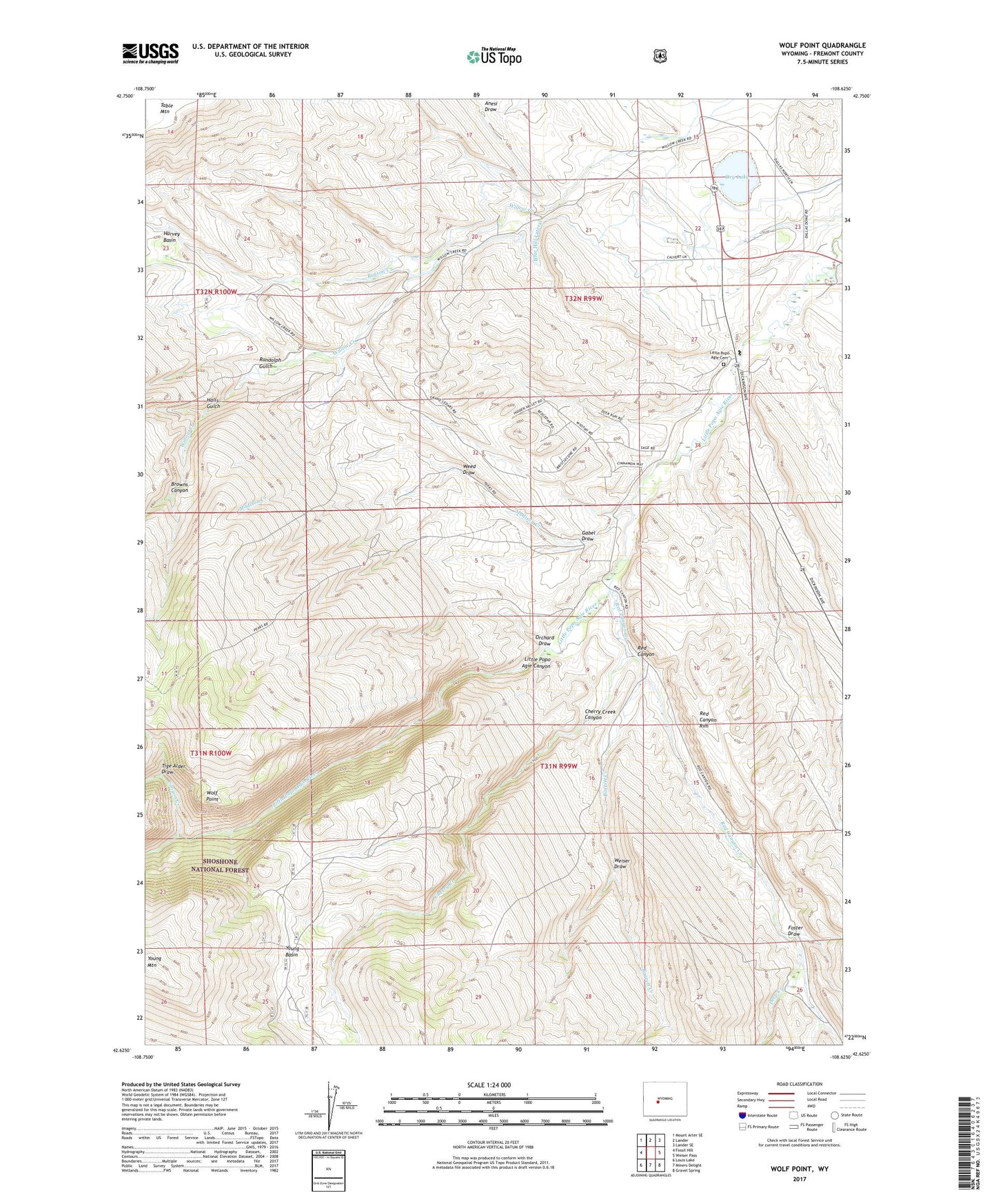
Wolf Point Wyoming US Topo Map
Couldn't load pickup availability
Also explore the Wolf Point Forest Service Topo of this same quad for updated USFS data
2021 topographic map quadrangle Wolf Point in the state of Wyoming. Scale: 1:24000. Based on the newly updated USGS 7.5' US Topo map series, this map is in the following counties: Fremont. The map contains contour data, water features, and other items you are used to seeing on USGS maps, but also has updated roads and other features. This is the next generation of topographic maps. Printed on high-quality waterproof paper with UV fade-resistant inks.
Quads adjacent to this one:
West: Fossil Hill
Northwest: Mount Arter SE
North: Lander
Northeast: Lander SE
East: Weiser Pass
Southeast: Gravel Spring
South: Miners Delight
Southwest: Louis Lake
This map covers the same area as the classic USGS quad with code o42108f6.
Contains the following named places: Barrett Creek, Barrett Creek Mine, Beason Creek, Blue Hill Lateral, Browns Canyon, Canyon Creek, Cherry Creek, Cherry Creek Canyon, Cherry Creek Mine, Deep Creek, Devils Creek, Dry Lake, Dry Lake Area Mine, Foster Draw, Gabel Draw, Halls Gulch, Harvey Basin, Little Popo Agie Canyon, Little Popo Agie Cemetery, Little Popo Agie River Mine, Lower Willow Creek School, Macfie Ranch, Macfie Ranch Mine, Madison Creek, Madison Creek School, Mat Weed Canyon Mine, Orchard Draw, Pan Group Mine, Pat Number Two Mine, Randolph Gulch, Red Canyon, Red Canyon Creek, Red Canyon Rim, Tige Alder Draw, Upper Willow Creek School, Weed Draw, Weiser Draw, Whitehead Ranch, Wilkinson Ranch, Wilkinson Sheep Sheds, Wolf Point, Young Basin, Young Mountain