MyTopo
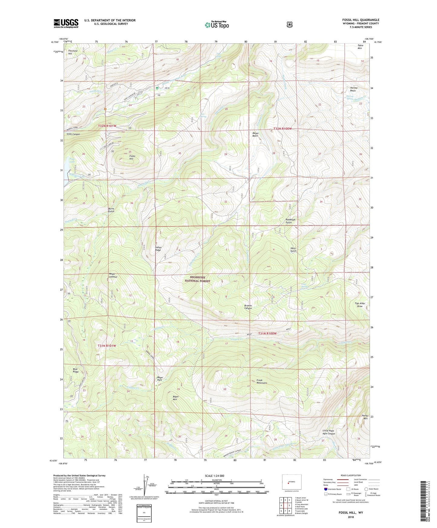
Fossil Hill Wyoming US Topo Map
Couldn't load pickup availability
Also explore the Fossil Hill Forest Service Topo of this same quad for updated USFS data
2021 topographic map quadrangle Fossil Hill in the state of Wyoming. Scale: 1:24000. Based on the newly updated USGS 7.5' US Topo map series, this map is in the following counties: Fremont. The map contains contour data, water features, and other items you are used to seeing on USGS maps, but also has updated roads and other features. This is the next generation of topographic maps. Printed on high-quality waterproof paper with UV fade-resistant inks.
Quads adjacent to this one:
West: Cony Mountain
Northwest: Mount Arter
North: Mount Arter SE
Northeast: Lander
East: Wolf Point
Southeast: Miners Delight
South: Louis Lake
Southwest: Christina Lake
This map covers the same area as the classic USGS quad with code o42108f7.
Contains the following named places: Bayer Mountain, Bayer Park, Bruce Campground, Bruce Picnic Area, Burnt Gulch, Cold Spring, Crooked Creek, Deer Spring, Elderberry Creek, Enterprise Dam, Enterprise Ditch, Enterprise Reservoir, Eversole Ranch, Fairfield Creek, Fossil Hill, Freak Mountains, Harvey Spring, Indian Ridge, Indian Trail, Meyer Basin, Meyer Lookout, Middle Fork Guard Station, Pass Creek, Sinks Canyon Campground, Spring Creek, Table Mountain, Table Mountain Number One Mine, Table Mountain Number Two Mine, The Sinks, Townsend Creek, University of Missouri Geology Camp, Walker Ditch, Wolf Trail