MyTopo
Wonder View Wyoming US Topo Map
Couldn't load pickup availability
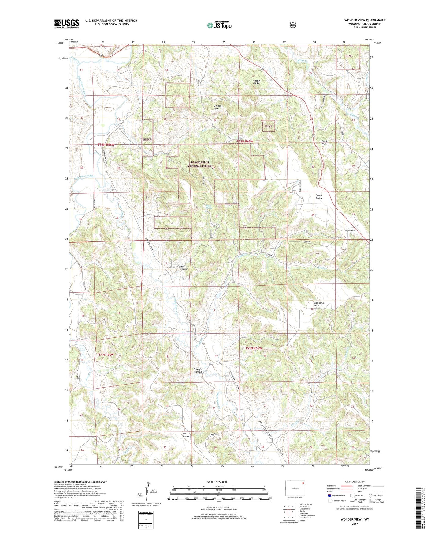
2021 topographic map quadrangle Wonder View in the state of Wyoming. Scale: 1:24000. Based on the newly updated USGS 7.5' US Topo map series, this map is in the following counties: Crook. The map contains contour data, water features, and other items you are used to seeing on USGS maps, but also has updated roads and other features. This is the next generation of topographic maps. Printed on high-quality waterproof paper with UV fade-resistant inks.
Quads adjacent to this one:
West: Carlile
Northwest: Missouri Buttes
North: Devils Tower
Northeast: Sherrard Hill
East: The Rocks
Southeast: Linden
South: Iron Mountain
Southwest: Grasshopper Butte
Contains the following named places: Cabin Creek, Castle Rocks, Corral Creek, East Creek, Graham Dam, Graham Ranch, Graham Reservoir, H K School, Huett Canyon, Huett Spring, Inyan Kara Creek, Keyhole Ranch, Miller Creek School, Myers Mine, Oak Creek, Old HK Ranch, Oudin Hill, Paul Myers Mine, Road Creek, Sawmill Canyon, Sunny Divide, Sunny Divide Mine, The Bank Lake, Tony One Mine, Wonder View, Zimmerman Ranch