MyTopo
Suggsville Alabama US Topo Map
Couldn't load pickup availability
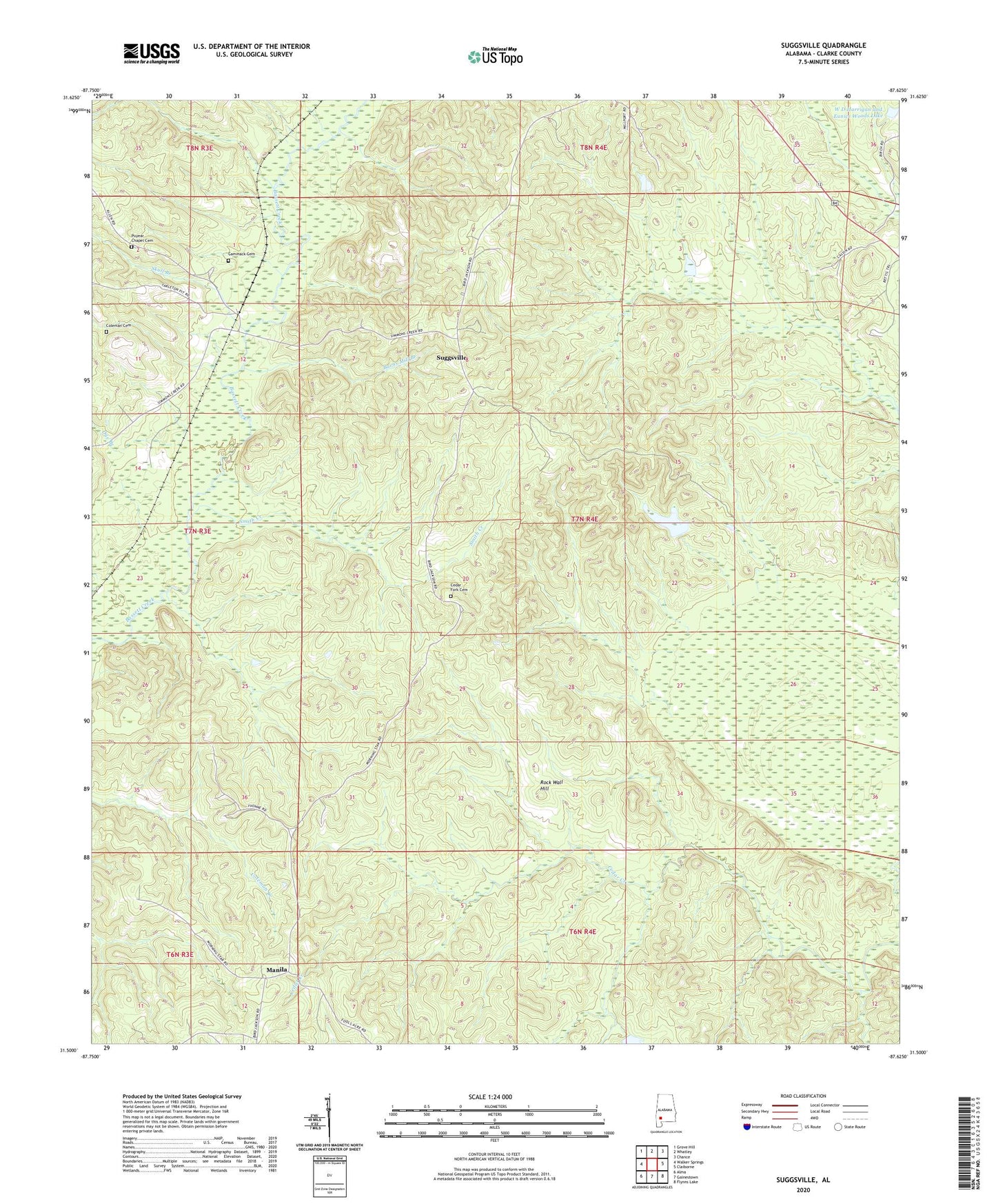
2024 topographic map quadrangle Suggsville in the state of Alabama. Scale: 1:24000. Based on the newly updated USGS 7.5' US Topo map series, this map is in the following counties: Clarke. The map contains contour data, water features, and other items you are used to seeing on USGS maps, but also has updated roads and other features. This is the next generation of topographic maps. Printed on high-quality waterproof paper with UV fade-resistant inks.
Quads adjacent to this one:
West: Walker Springs
Northwest: Grove Hill
North: Whatley
Northeast: Chance
East: Claiborne
Southeast: Flynns Lake
South: Gainestown
Southwest: Alma
This map covers the same area as the classic USGS quad with code o31087e6.
Contains the following named places: Allen, Allen Church, Barns Mill Branch, Cammack Cemetery, Cedar Fork, Cedar Fork Cemetery, Cedar Fork Church, Coleman Cemetery, Dye Branch, Fort Glass, Fort Madison, Gillmore Plantation, Hickory Hall, Little Burrough Church, Manila, Mount Horeb Church, Purrears Chapel, Puyear Chapel, Puyear Chapel Cemetery, Rock Wall Hill, Saint Peters Church, Skull Branch, Smith Creek, Suggsville, W D Harrigan and Eunice H Woods Dam, W D Harrigan and Eunice Woods Lake, Weighman Chapel African Methodist Episcopal Zion Church