MyTopo
Bellefontaine Alabama US Topo Map
Couldn't load pickup availability
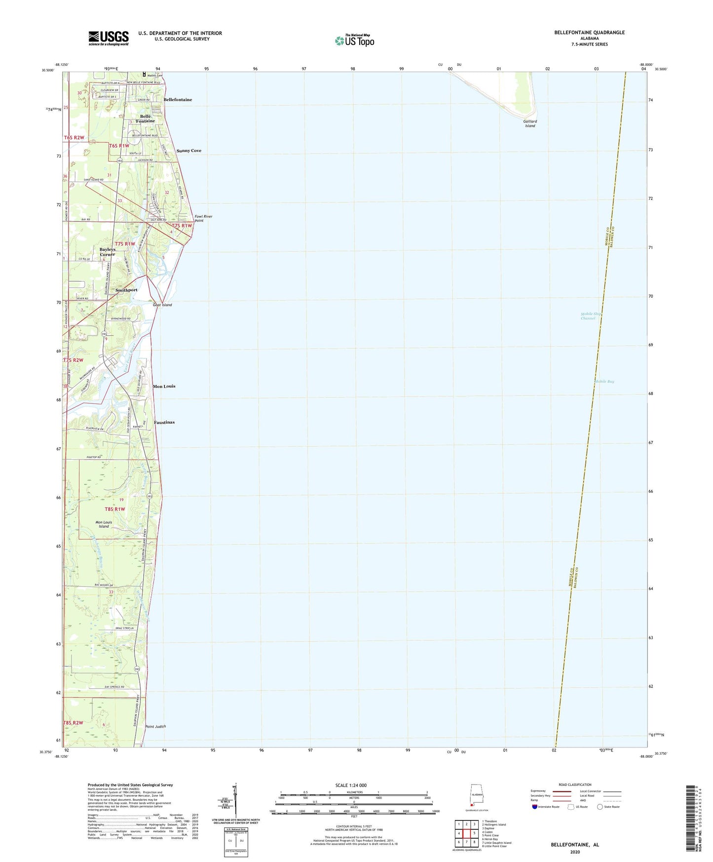
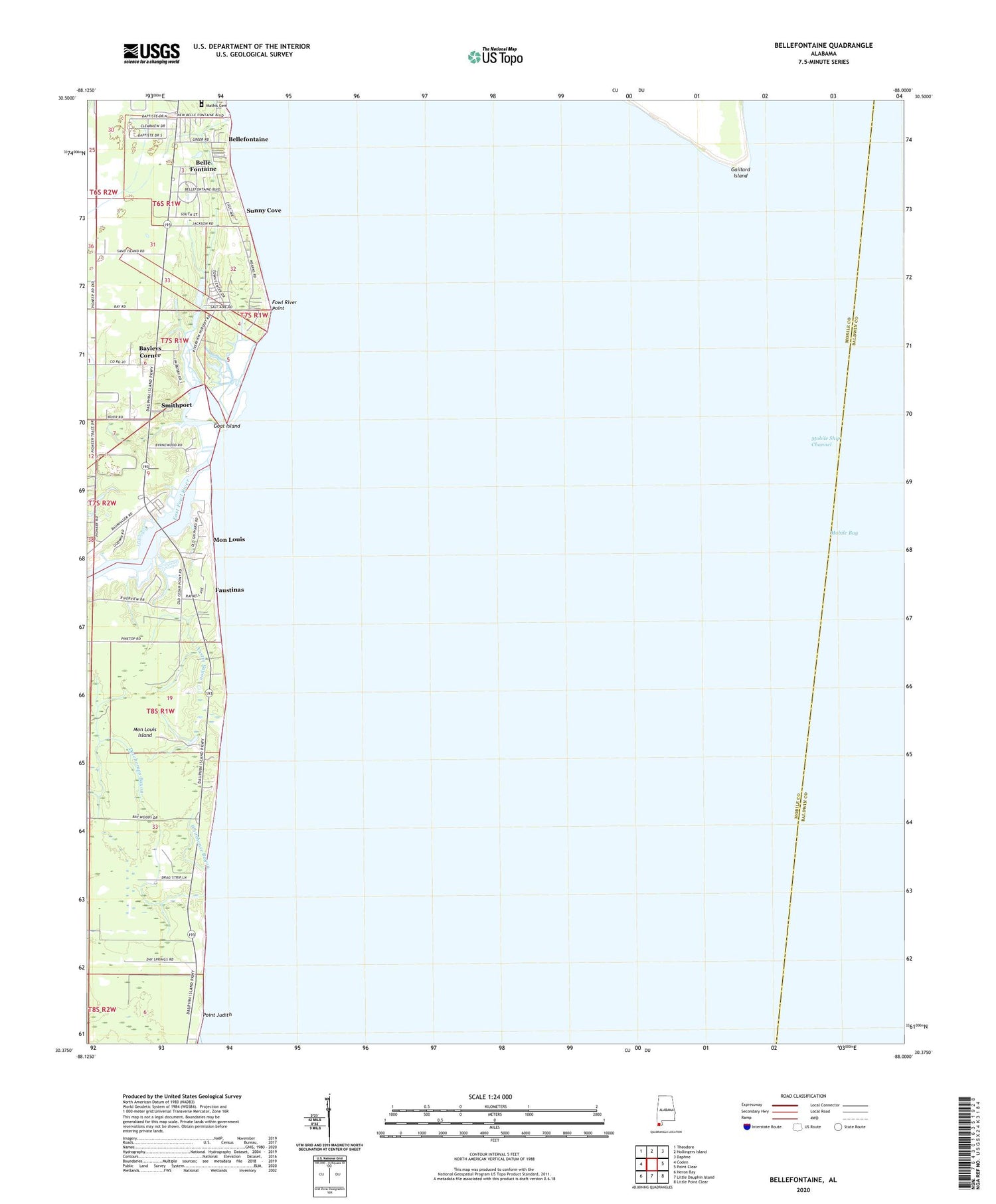
2024 topographic map quadrangle Bellefontaine in the state of Alabama. Scale: 1:24000. Based on the newly updated USGS 7.5' US Topo map series, this map is in the following counties: Mobile, Baldwin. The map contains contour data, water features, and other items you are used to seeing on USGS maps, but also has updated roads and other features. This is the next generation of topographic maps. Printed on high-quality waterproof paper with UV fade-resistant inks.
Quads adjacent to this one:
West: Coden
Northwest: Theodore
North: Hollingers Island
Northeast: Daphne
East: Point Clear
Southeast: Little Point Clear
South: Little Dauphin Island
Southwest: Heron Bay
This map covers the same area as the classic USGS quad with code o30088d1.
Contains the following named places: Austin Bayou, Baumhauer Road Baptist Church, Bayleys Corner, Belle Fontaine Census Designated Place, Bellefontaine, Bellefontaine Church, Boudans Cemetery, Delchamps Bayou, East Fowl River, Faustinas, Fowl River Marina, Fowl River Point, Goat Island, Mathis Cemetery, Mobile Bay, Mobile Bay Light, Mobile Ship Channel, Mon Louis, Pecan Grove Trailer Park, Point Judith, Point Judith Gas Field, S A Barrett Dam, Saint Rose Church, Smithport, South Mobile First Baptist Church, Sunny Cove, Whitehouse Bayou, WMOZ-AM (Mobile)