MyTopo
Point Clear Alabama US Topo Map
Couldn't load pickup availability
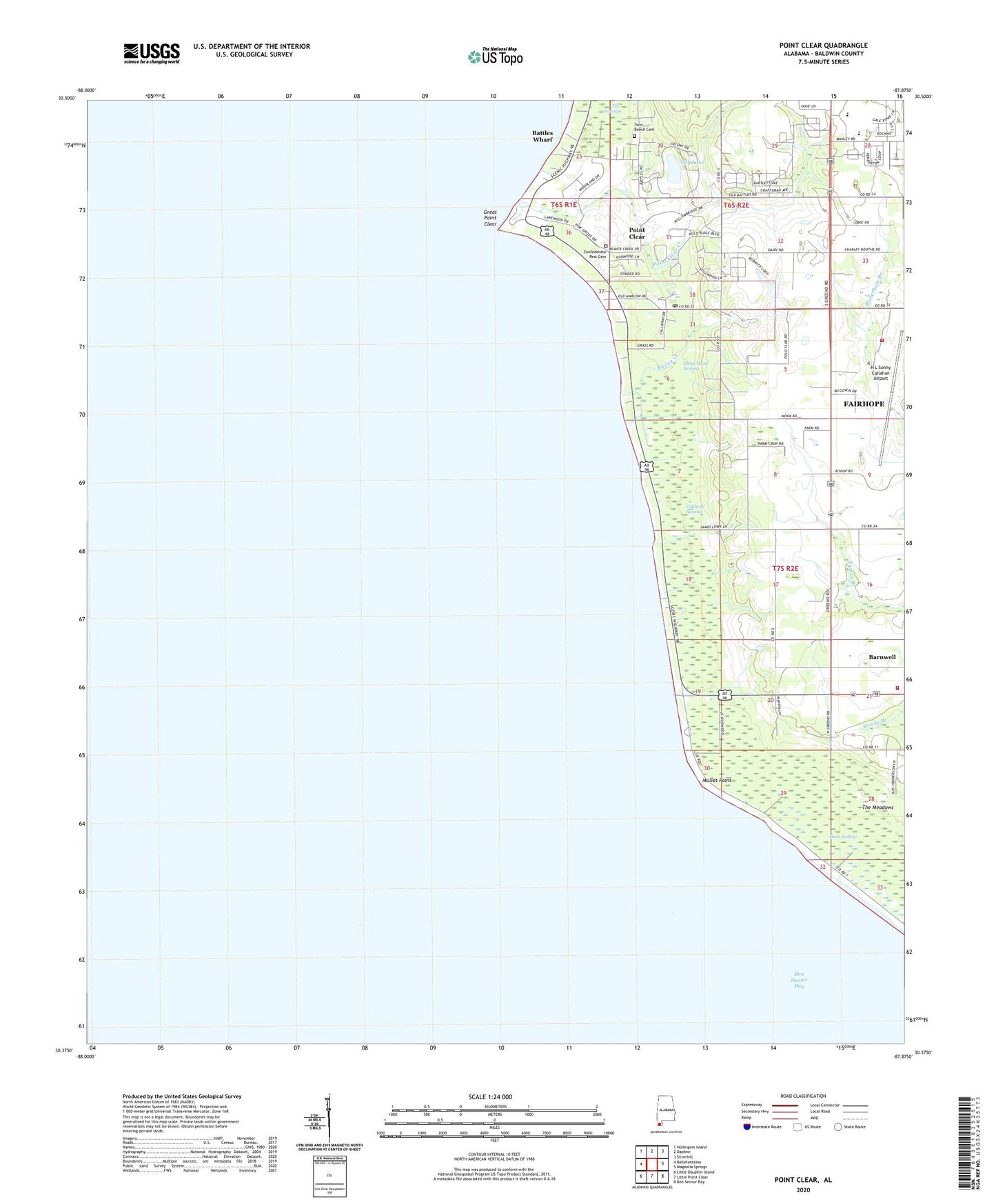
2024 topographic map quadrangle Point Clear in the state of Alabama. Scale: 1:24000. Based on the newly updated USGS 7.5' US Topo map series, this map is in the following counties: Baldwin. The map contains contour data, water features, and other items you are used to seeing on USGS maps, but also has updated roads and other features. This is the next generation of topographic maps. Printed on high-quality waterproof paper with UV fade-resistant inks.
Quads adjacent to this one:
West: Bellefontaine
Northwest: Hollingers Island
North: Daphne
Northeast: Silverhill
East: Magnolia Springs
Southeast: Bon Secour Bay
South: Little Point Clear
Southwest: Little Dauphin Island
This map covers the same area as the classic USGS quad with code o30087d8.
Contains the following named places: Bailey Creek, Barnwell, Barnwell Baptist Church, Barnwell Gas Field, Barnwell Volunteer Fire and Rescue Department, Battles Wharf, Bethel Church, Bryant Landing, Caldwell Swamp, Camp Cullen Summer Camp, Confederate Rest Cemetery, Darling Landing, Fairhope Airport Technical Park, Fairhope Division, Fairhope Volunteer Fire Department Station 3, Faith Baptist Church, Foots Landing, Ghost Head Swamp, Great Point Clear, Gum Swamp, H L Sonny Callahan Airport, Lakewood Country Club, Lily Lake, Mullet Point, Mullet Point Park, Point Clear, Point Clear Census Designated Place, Point Clear Church, Point Clear Creek, Point Clear Post Office, Point Clear School, Sacred Heart Catholic Church, Titi Swamp, Twin Beech Cemetery, ZIP Code: 36564