MyTopo
Berry Alabama US Topo Map
Couldn't load pickup availability
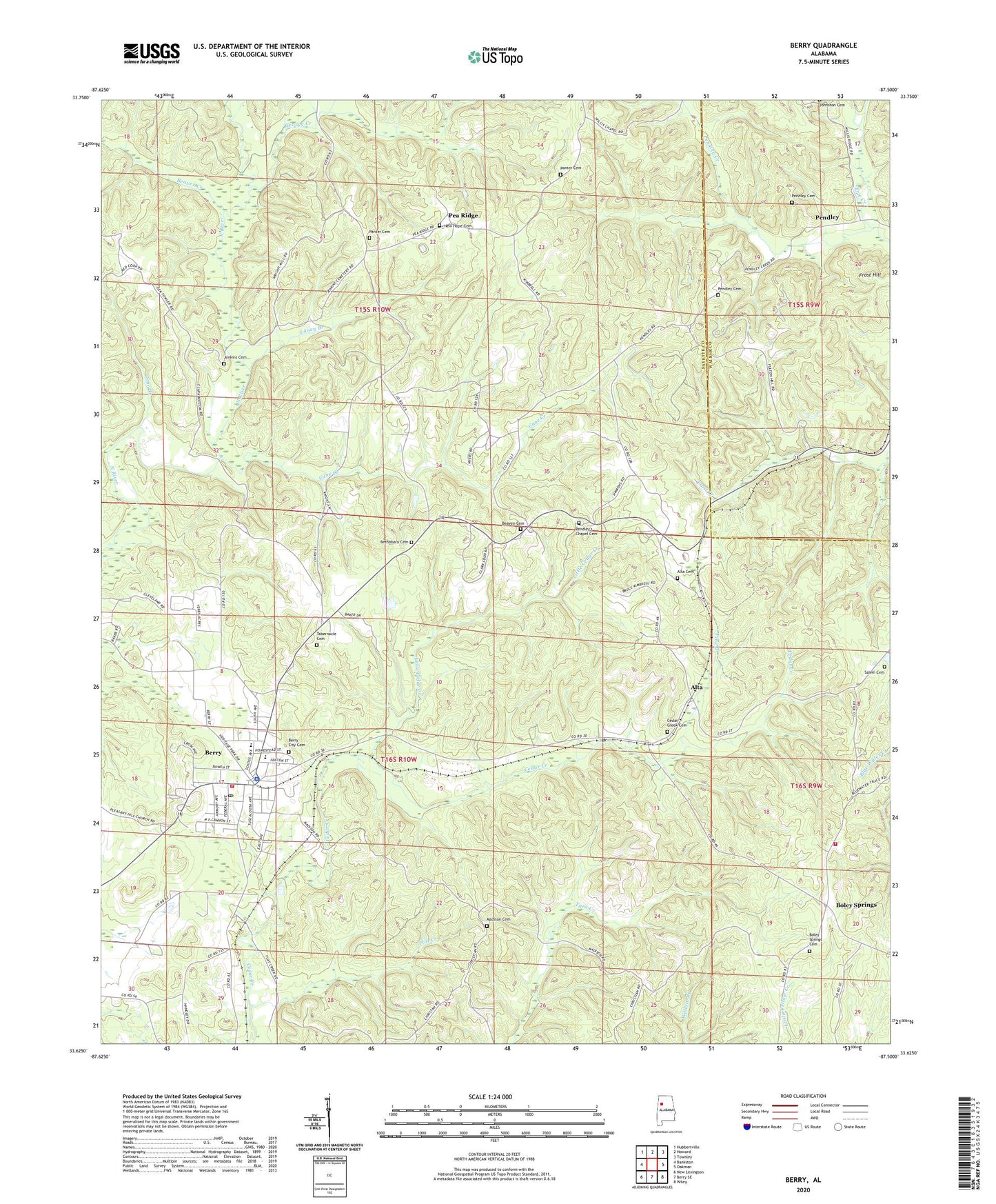
2024 topographic map quadrangle Berry in the state of Alabama. Scale: 1:24000. Based on the newly updated USGS 7.5' US Topo map series, this map is in the following counties: Fayette, Walker. The map contains contour data, water features, and other items you are used to seeing on USGS maps, but also has updated roads and other features. This is the next generation of topographic maps. Printed on high-quality waterproof paper with UV fade-resistant inks.
Quads adjacent to this one:
West: Bankston
Northwest: Hubbertville
North: Howard
Northeast: Townley
East: Oakman
Southeast: Wiley
South: Berry SE
Southwest: New Lexington
This map covers the same area as the classic USGS quad with code o33087f5.
Contains the following named places: Alabama Christian College, Alta, Alta Cemetery, Alta Church, Arbor Springs Church, Beaven Cemetery, Beaver Creek, Berry, Berry Baptist Church, Berry Church of Christ, Berry City Cemetery, Berry Division, Berry Elementary School, Berry High School, Berry Methodist Church, Berry Police Department, Berry Post Office, Berry Volunteer Fire Department, Bethabara Cemetery, Bethabara Church, Bevans Chapel, Boley Church, Boley Spring School, Boley Springs, Boley Springs Cemetery, Boley Springs Church, Boley Volunteer Fire Department, Calvary Church, Cane Creek, Cedar Creek Cemetery, Corona Number 20 Mine, Erie Creek, Flat Creek, Fred Webster Stadium, Frost Hill, George Creek, Jenkins Cemetery, Laney Branch, Little Cedar Creek, Madison Cemetery, Mount Joy Church, Nazarene Church of Berry, New Hope Cemetery, New Hope Church, Oak Grove School, Old Salem Church, Panter Cemetery, Pea Ridge, Pea Ridge Church of Christ, Pea Ridge Number 1 Mine, Pendley, Pendley Cemetery, Pendley Chapel, Pendley's Chapel Cemetery, Pilgrim Chapel, Pine Branch, Salem Cemetery, Star Branch, Tabernacle Cemetery, Tabernacle Church, Thornton Branch, Town of Berry