MyTopo
Hubbertville Alabama US Topo Map
Couldn't load pickup availability
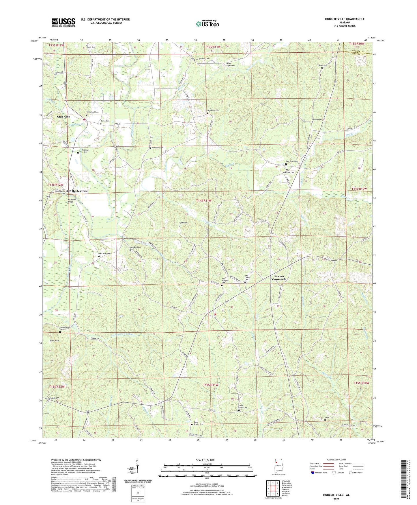
2024 topographic map quadrangle Hubbertville in the state of Alabama. Scale: 1:24000. Based on the newly updated USGS 7.5' US Topo map series, this map is in the following counties: Fayette, Walker. The map contains contour data, water features, and other items you are used to seeing on USGS maps, but also has updated roads and other features. This is the next generation of topographic maps. Printed on high-quality waterproof paper with UV fade-resistant inks.
Quads adjacent to this one:
West: Winfield SE
Northwest: Winfield
North: Glen Allen
Northeast: Carbon Hill
East: Howard
Southeast: Berry
South: Bankston
Southwest: Fayette
This map covers the same area as the classic USGS quad with code o33087g6.
Contains the following named places: Barron Creek, Berea Cemetery, Berea Church of Christ, Boxes Creek, Boxes Creek Gas Field, Boxes Creek School, Cedar Grove Cemetery, Cedar Grove Church, Davis Chapel, Davis Chapel Cemetery, Davis Chapel Gas Field, Dobbs Cemetery, Dry Creek, Ford Mountain, Fowler Crossroads Volunteer Fire Department, Fowlers Crossroads, Hollingsworth Cemetery, Hollingsworth Mill Creek, Hubbertsville Gas Field, Hubbertville, Hubbertville Cemetery, Hubbertville Church of Christ, Hubbertville High School, Hubbertville Volunteer Fire Department, Isom Creek, Little Creek, Mac-Jer Dairy, Mayfield Cemetery, Mayfield Church, McCollum Bridge, McCollum Cemetery, Mill Creek, Morris Cemetery, Mount Home Baptist Church, New Liberty Cemetery, New Liberty Church, New Prospect Cemetery, New Prospect Primitive Baptist Church, New River Baptist Church, New River Cemetery, New River Church, New River Church of Christ, New River Hunting Club, New River Primitive Baptist Church, Northeast Davis Chapel Gas Field, Northeast Fayette Division, Phillips Cemetery, Rehobeth Cemetery, Rehobeth Church, Sprinkle Cemetery, Studhorse Creek, Thornton Cemetery, Tidwell Cemetery, Tidwell Chapel, Tidwell Chapel Cemetery, Turkey Creek, Wade Cemetery, Whitehead Cemetery, Wiley Hollingsworth Stadium


